Top 8 spots to visit on a tight schedule
Death Valley National Park is one of largest national parks in the United States. It has plenty of terrain to explore, and every spot feels completely different from the previous one. After having spent a day exploring here this past April, these are the best 8 spots to visit that’ll leave you feeling content with your journey.
*If your attention span is like MINE, you can instead watch this short 90 second video on my Tiktok that summarizes all 8 spots.
When you start planning your trip, you may start (as I do) by looking online at photos of the park to see what spots you would be interested in. However, nothing is MORE important than talking to the park rangers at the Visitors Center when you arrive to see if the places you WANT to see are realistic (either because of time constraints, access, or difficulty). A prime example of this occurred at Death Valley with the iconic moving rocks. I was VERY excited to find these. I was VERY disappointed to learn it wouldn’t be possible for me. This is because the road to that location is the most common spot for tires to pop and is an extremely sharp and bumpy 3 hour drive that only 4-wheel drive vehicles can handle.
The following list avoids spots like that! In fact, these are all spots that are very easy to get to. Albeit, some have narrow parts and bumpy gravel roads, but I drive a Subaru Crosstrek and had no particularly big issues. I will talk about which areas are of more concern, should that be YOUR concern.
On a side note, this is just one of many stops I took during my Great Western American Road Trip. You can learn more about that full trip here for tips on other iconic parks like Yosemite, Redwoods, and Yellowstone:
Read about that amazing journey
I should of course tell you, overall, to be SAFE in Death Valley. I went in Spring and found the weather to be fantastic, with it not being particularly hot most of the time. But if you are going in summer (which I don’t really recommend), bring plenty of water, sunscreen, hats, and stay fueled up. There are a few spots that even warn you not to use your AC while driving through.
The overall philosophy for a day trip, at least for a photographer, is trying to see as many spots as you can but at an enjoyable pace. You don’t have time for 3+ mile hikes. This list is fully manageable in one day, so long as you take advantage and start prepared at sunrise at the first spot. Without further ado, here we go!
INDEX:
1. Zabriskie Point
2. Badwater Basin
3. Devil’s Golf Course
4. Artist’s Drive
5. Keane Wonder Mine
6. Rhyolite Ghost Town
7. Aguereberry Point
8. Eureka Mine
Honorable Mentions
Conclusion
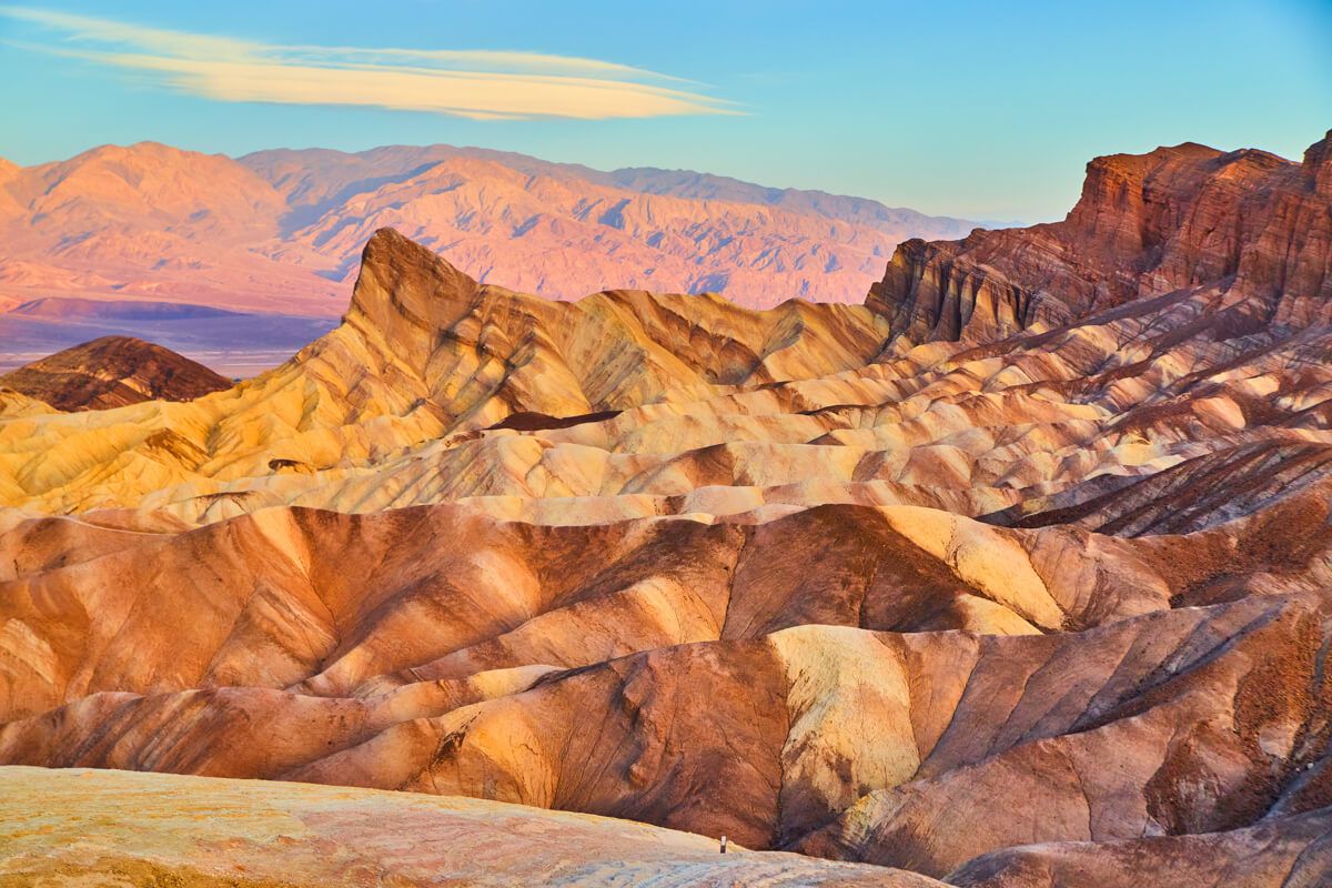
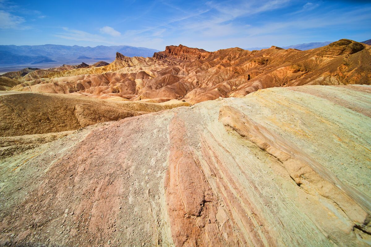
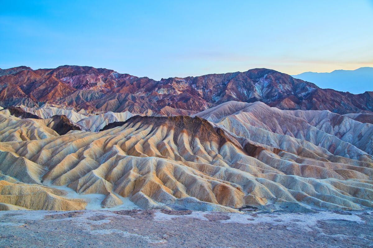
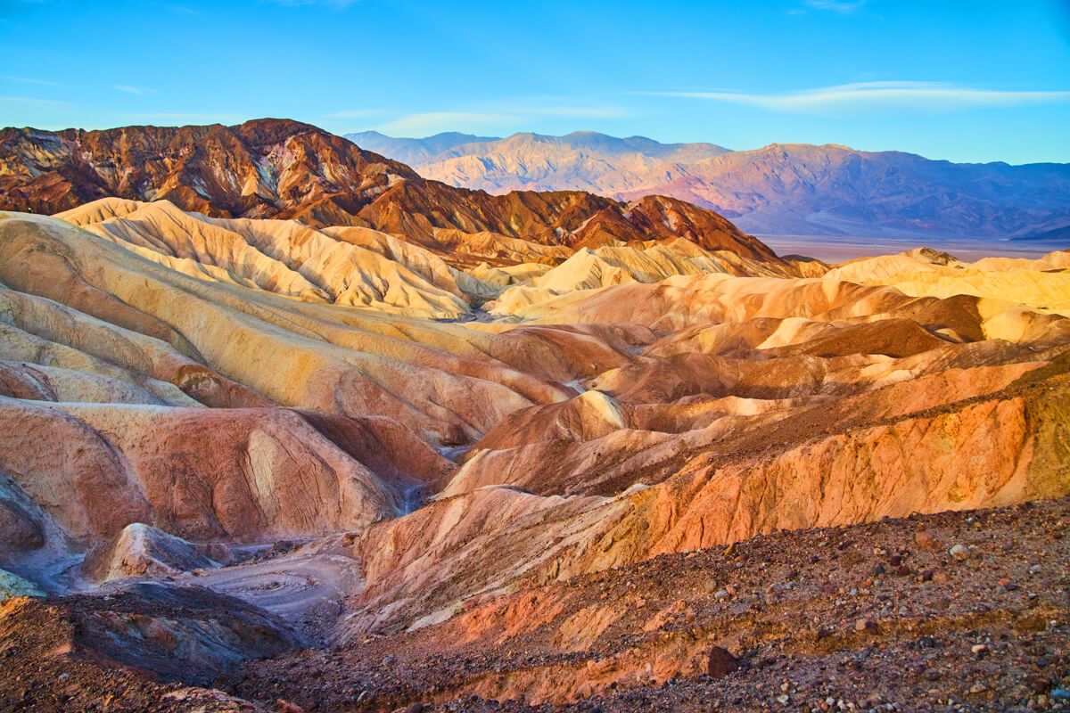
1. Zabriskie Point
Everyone will tell you that this is the most stunning spot in the entire park - and I have to agree! I wish it wasn’t so, since it is the popular spot everyone goes to. But, it just is for a good reason. It is highly recommended to START your journey here. One, it is most stunning during sunrise. DO IT! I also was here in the afternoon and at night for astrophotography, but it was by far best viewed at sunrise (not sunset).
I opted to also take a short hike away from the main overlook for a different view, but the overlook does a fantastic job! If you have more time, you can of course explore more in depth into this area.
Ease of Access - 10/10 - Couldn’t be easier. Paved road to paved parking lot. Paved slope for maybe a 5 minute walk to the overlook.
On the edge during midday
After sunset
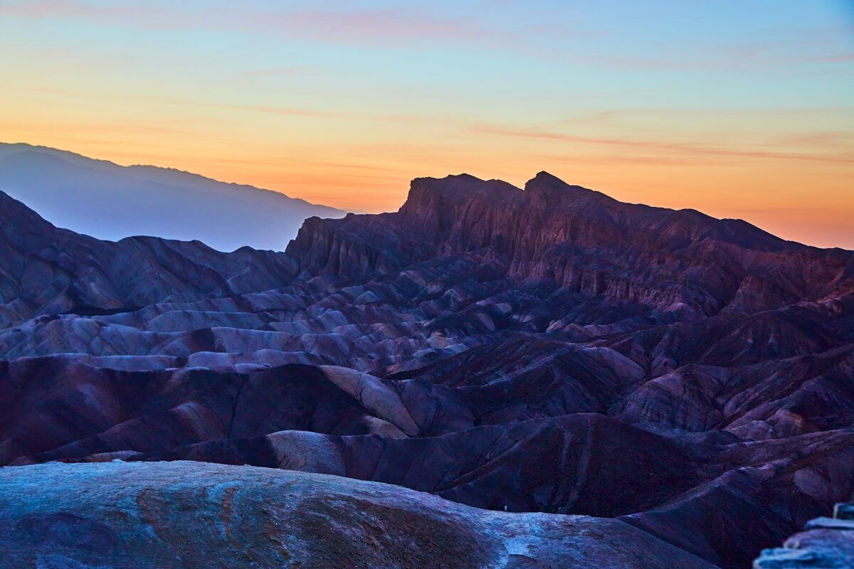
Before sunrise
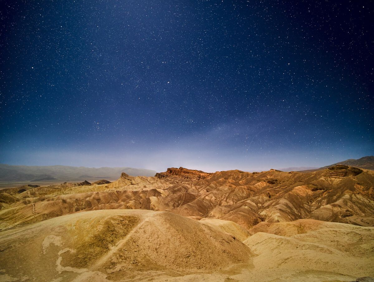
Astrophotography over Zabriskie
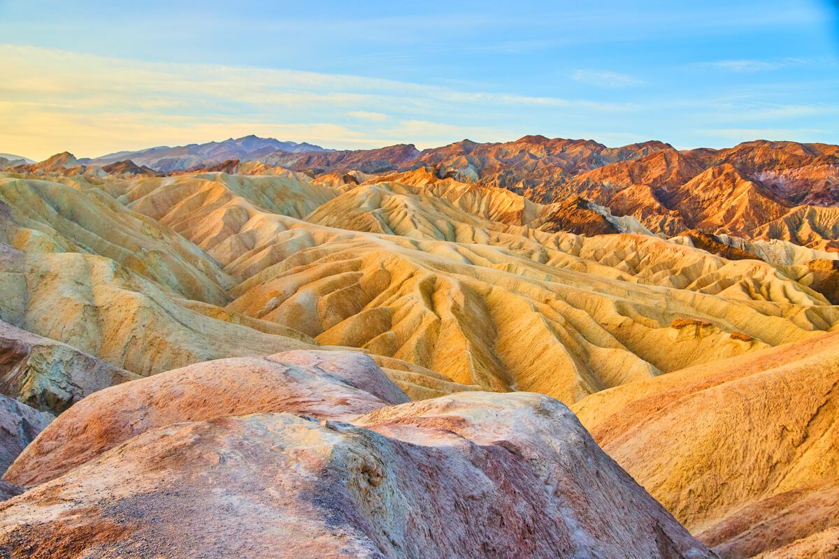
Waves of endless colors at sunrise
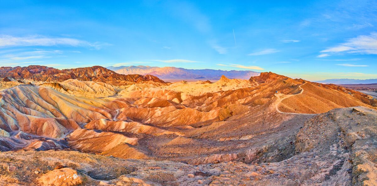
Panorama of entire valley with hiking trail
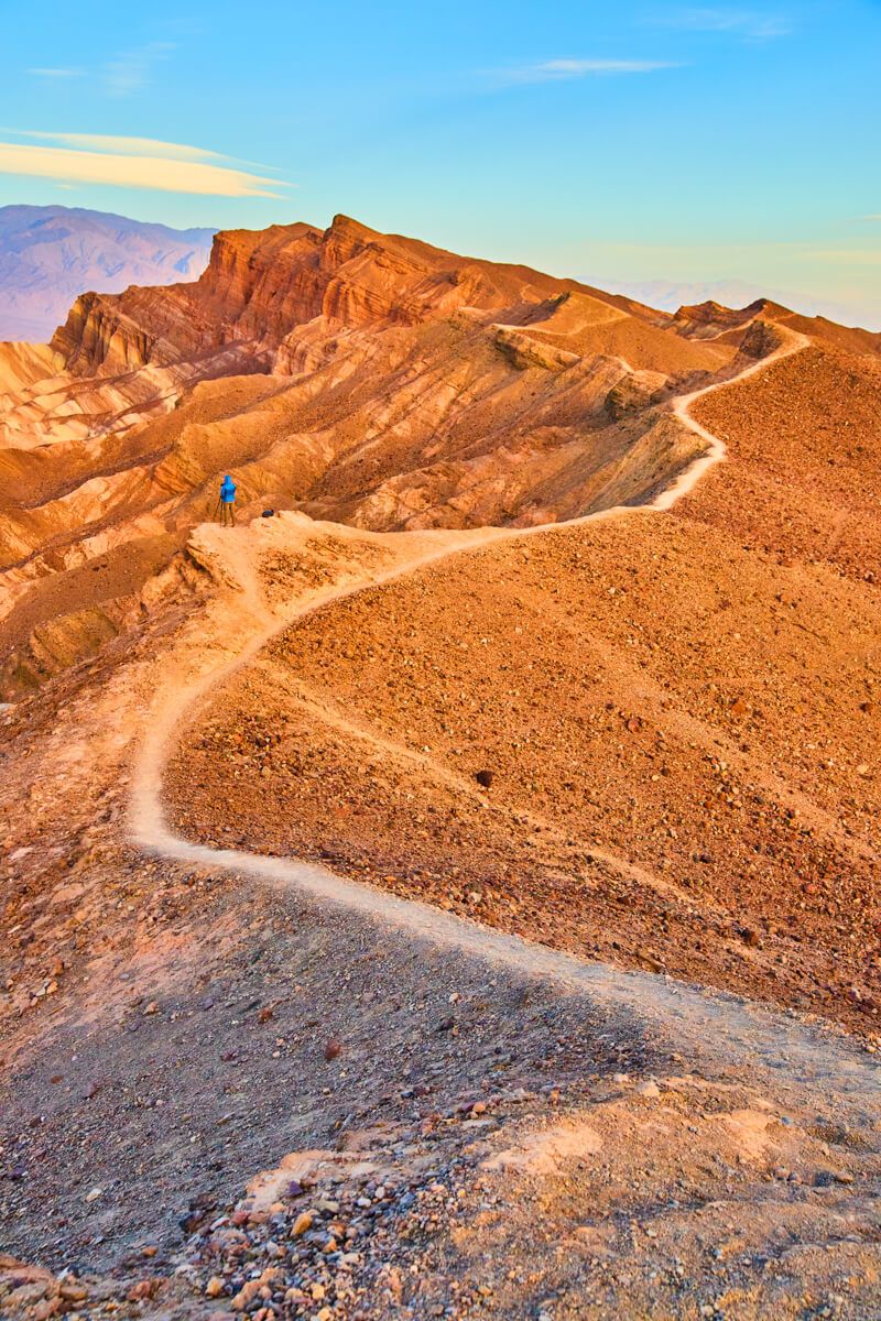
Hiking away from the main spot for a different perspective
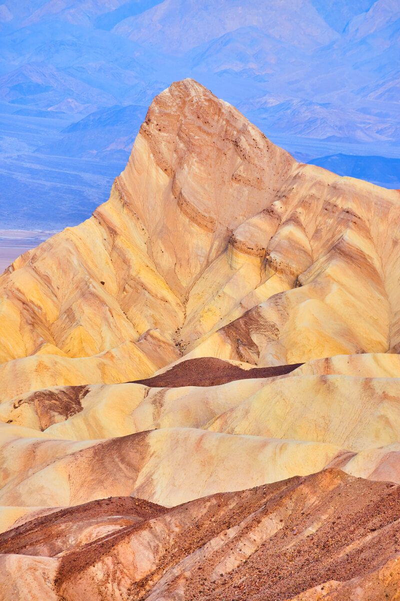
Detail of main peak
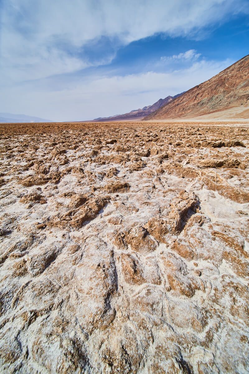
2. Badwater Basin
This spot, along with the next 2, are located very close together (all on Badwater Road that T’s off from Highway 190 at Furnace Creek) and also not far from Zabriskie Point. All 4 of these spots (1 through 4 on my list) are in the southeast corner of the park and near a couple of lodging spots right in the park and near the visitors center.
Known for the octagon salt formations, this spot is definitely worth visiting. You may be disappointed, like I was, to learn that the photos you SEE of this are NOT what it looks like any longer. It used to have a very distinct contrast of white salts coming out of the cracks. It has changed over time and now is all kind of just…brown… But it is iconic regardless!
The further you walk out into the basin, the narrower the path gets (from 30 feet wide down to just a few feet wide) and I will say it is worth walking a good 10 or 15 minutes out to see the more expected octagon formations. You can see below how the terrain can vary.
Ease of Access - 10/10 - The paved road goes straight to a paved parking lot and from there a very small set of stairs leads to the flat basin. From there, you can walk 10 feet or a mile out into the basin, that is up to you!
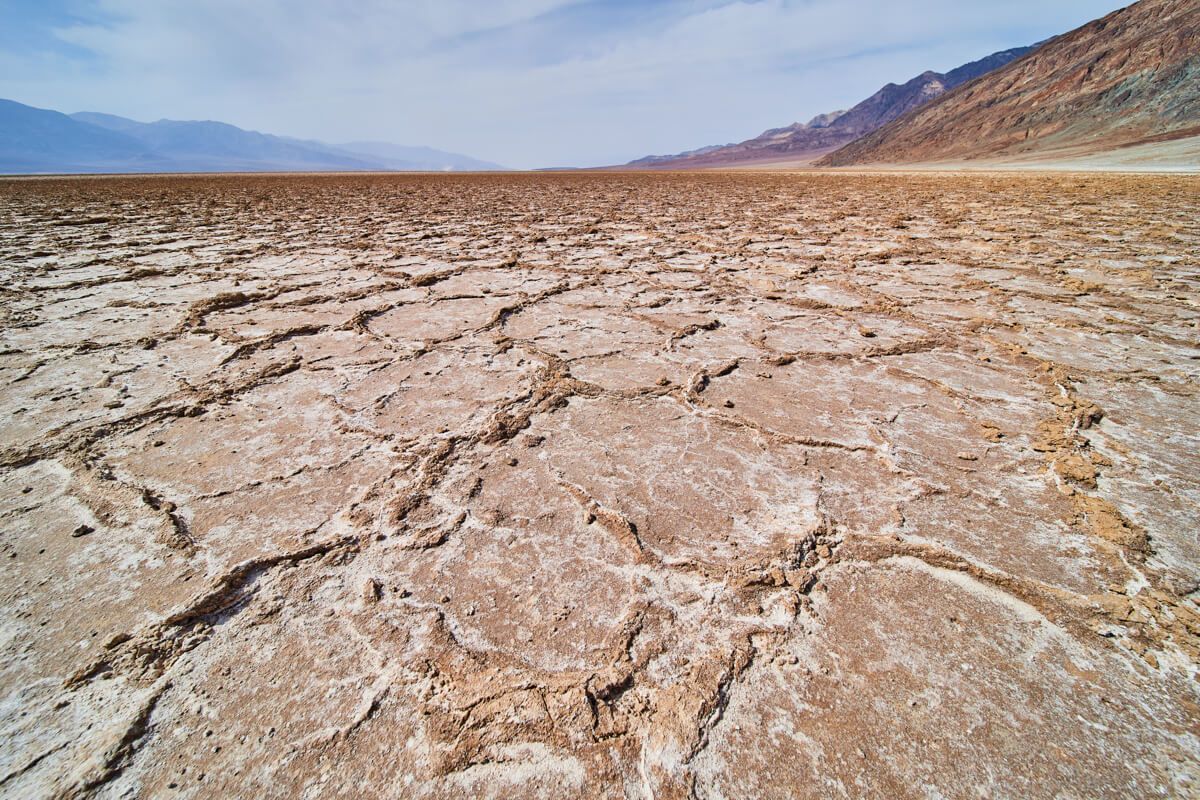
Formations of salt
Detail of formations
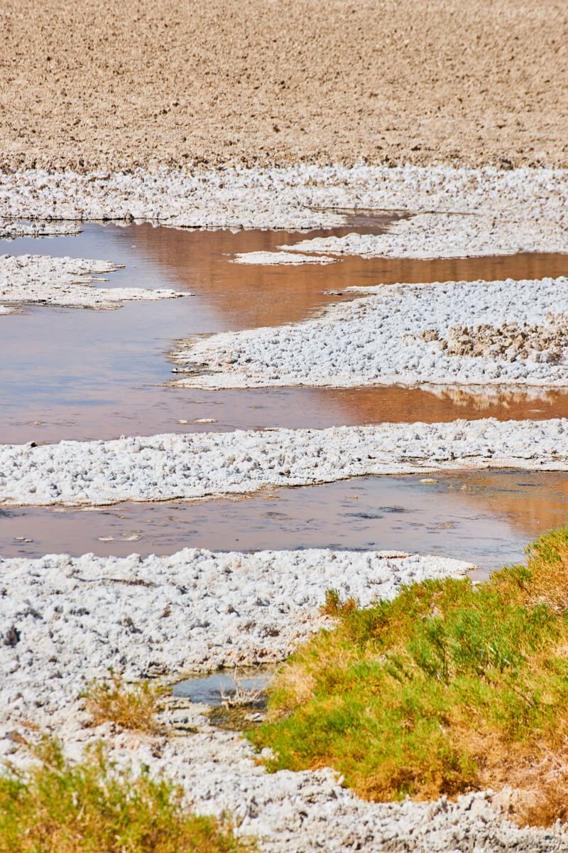
Patches of water in the basin
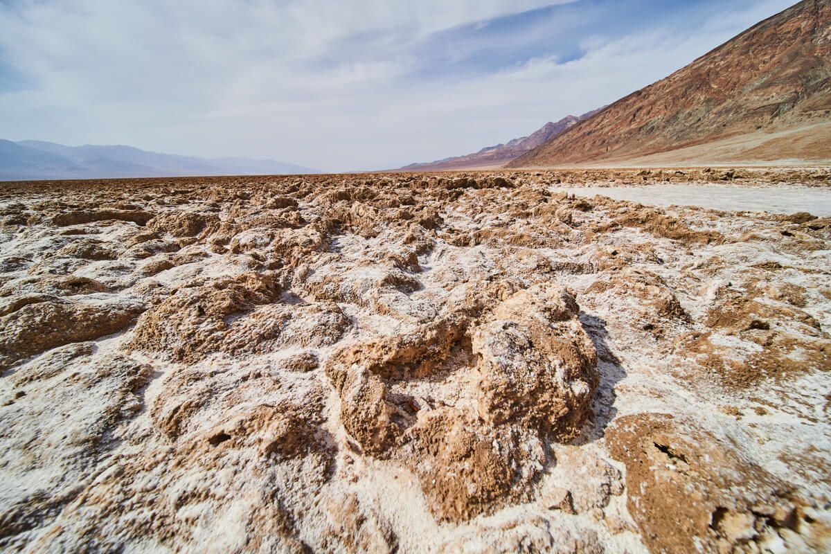
3. Devil’s Golf Course
You will have likely passed by this spot if you went to Badwater Basin (as it is just to the north of it). This is a very small spot that has similar salt formations to Badwater Basin, but they are a bit larger and sharper. Since it is so close, it is a great use of your time to check this out!
Ease of Access - 9/10 - The main road does then turn to dirt leading to this small dirt parking lot. But, it is very flat and relatively smooth so it is still very easy to access.
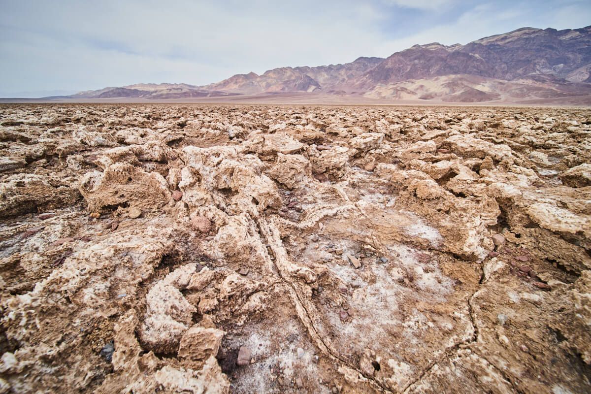
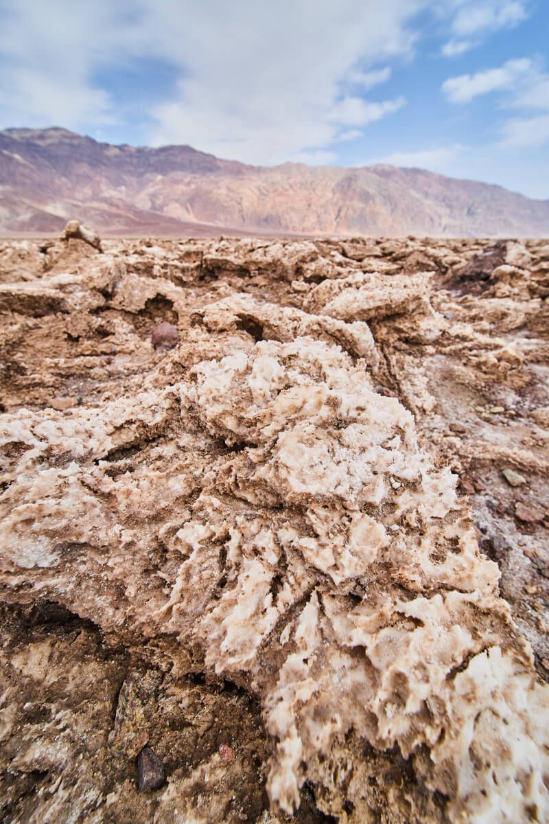
Up close to formations
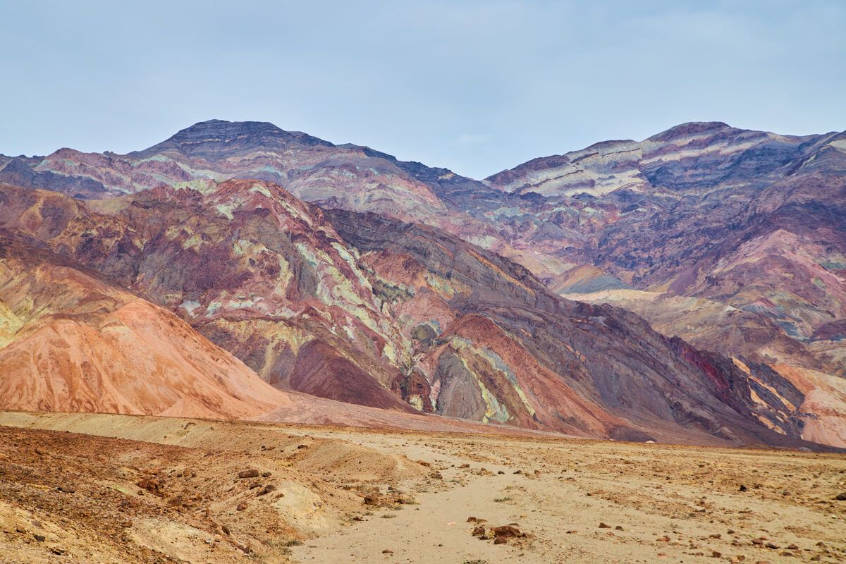
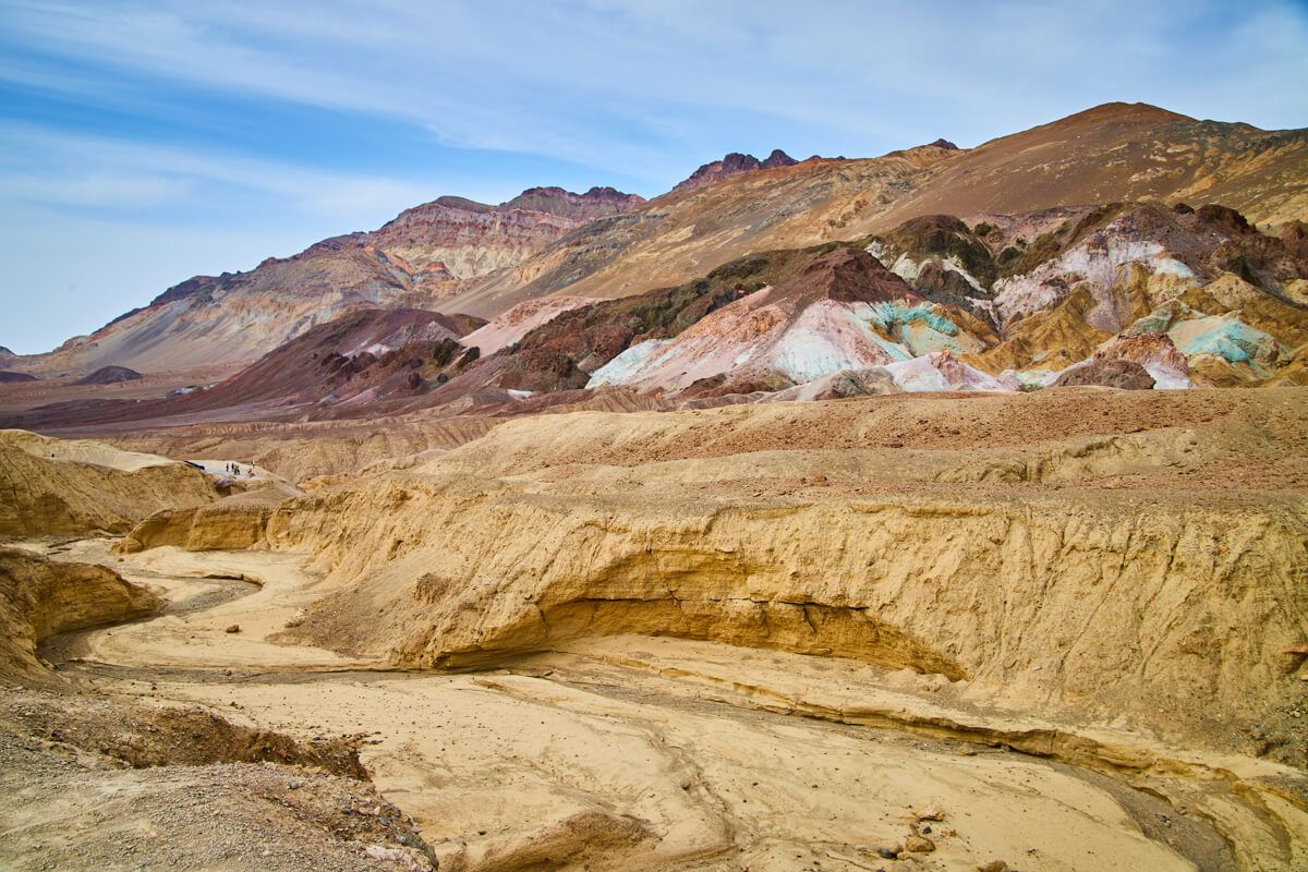
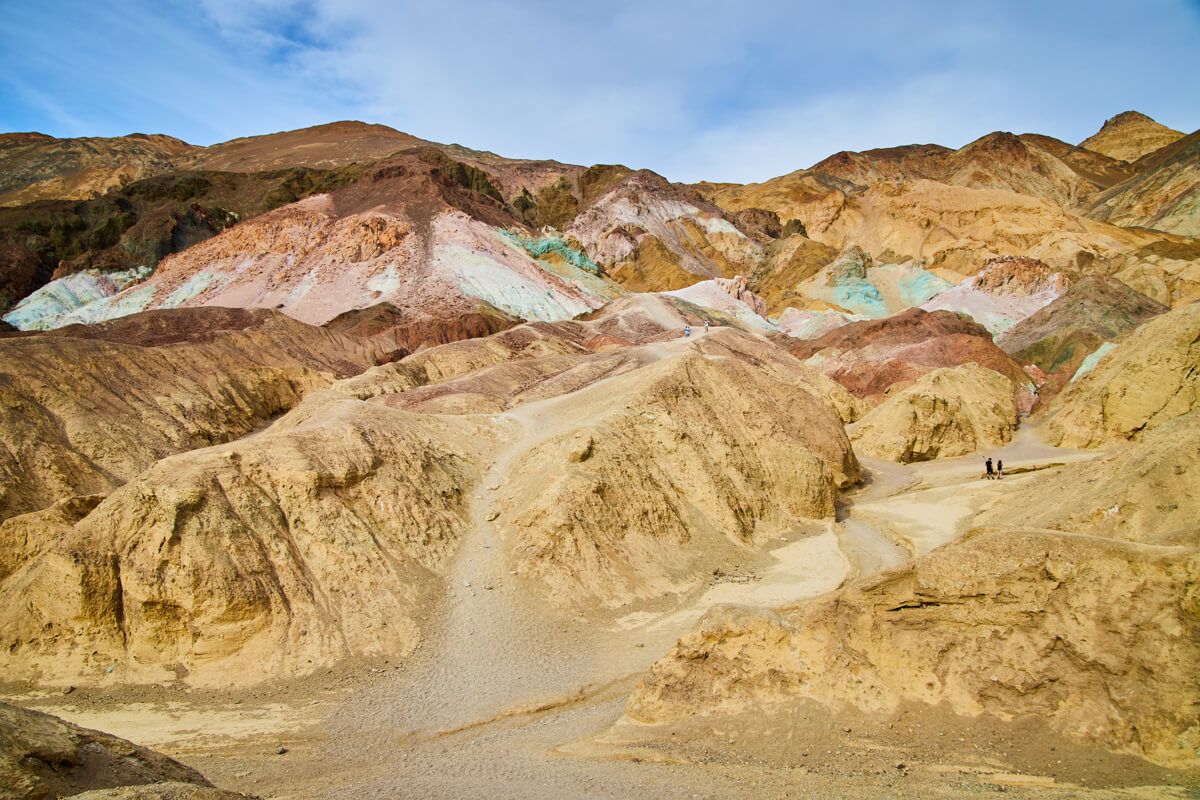
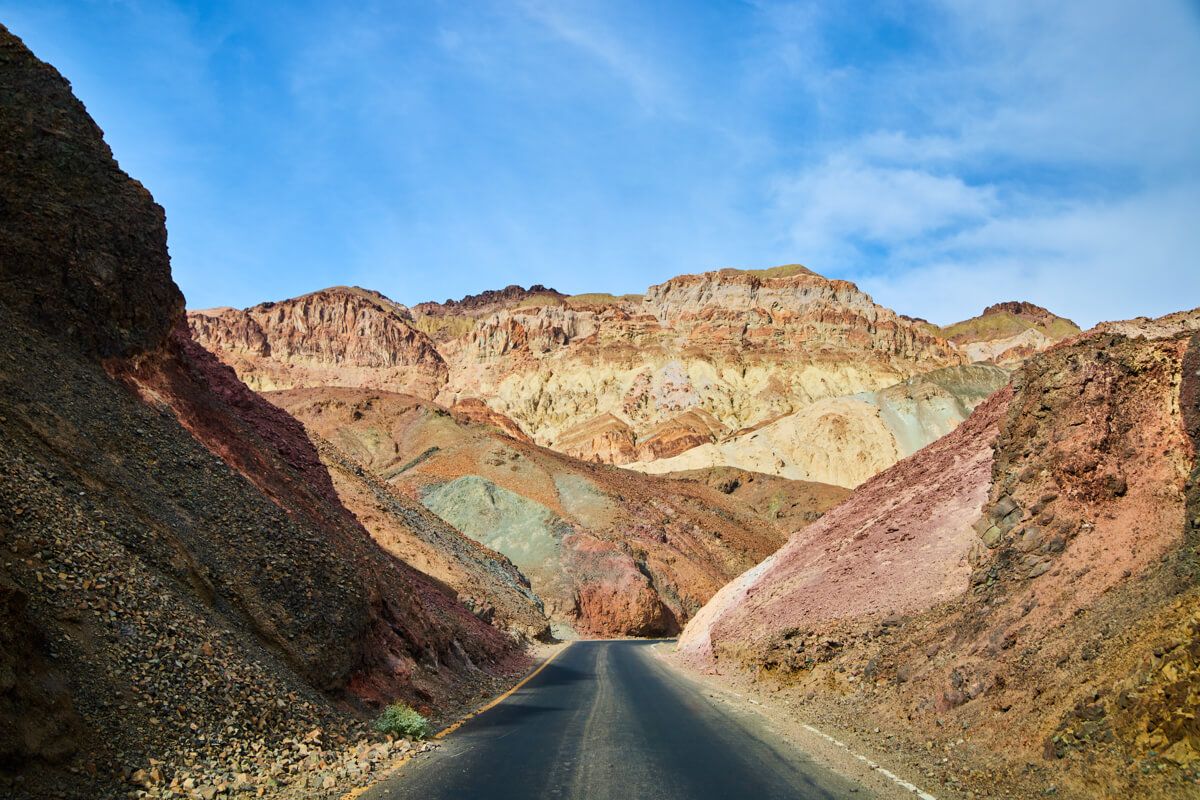
4. Artist’s Drive
Yes, again, you will have likely passed this spot if you went to Badwater Basin and Devil’s Golf Course. This is a one way road, so you will start from the south and then the road takes you on a wonderful journey through some stunning colorful mountains (similar to Zabriskie Point).
You can’t turn around and it is a good length of road, so be prepared to be in here for at least an hour or two of your day (depending on how much you stop). There are two main spots you will want to stop at that let you walk up close to two particularly colorful mountains.
Beyond that, honestly the drive itself (more towards the second half) is absolutely stunning. It is a one lane road that gets relatively narrow and winds down and directly through the mountains. Go slow and be safe!
Ease of Access - 10/10 - The entire one way road is paved and wide enough for all vehicles except for 20+ feet (I believe). So, despite all of the winding it is a super easy and safe drive if you pay attention.
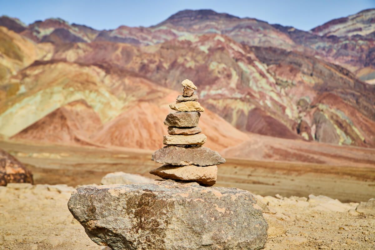
Cairne stack of rocks at Artist's Palette
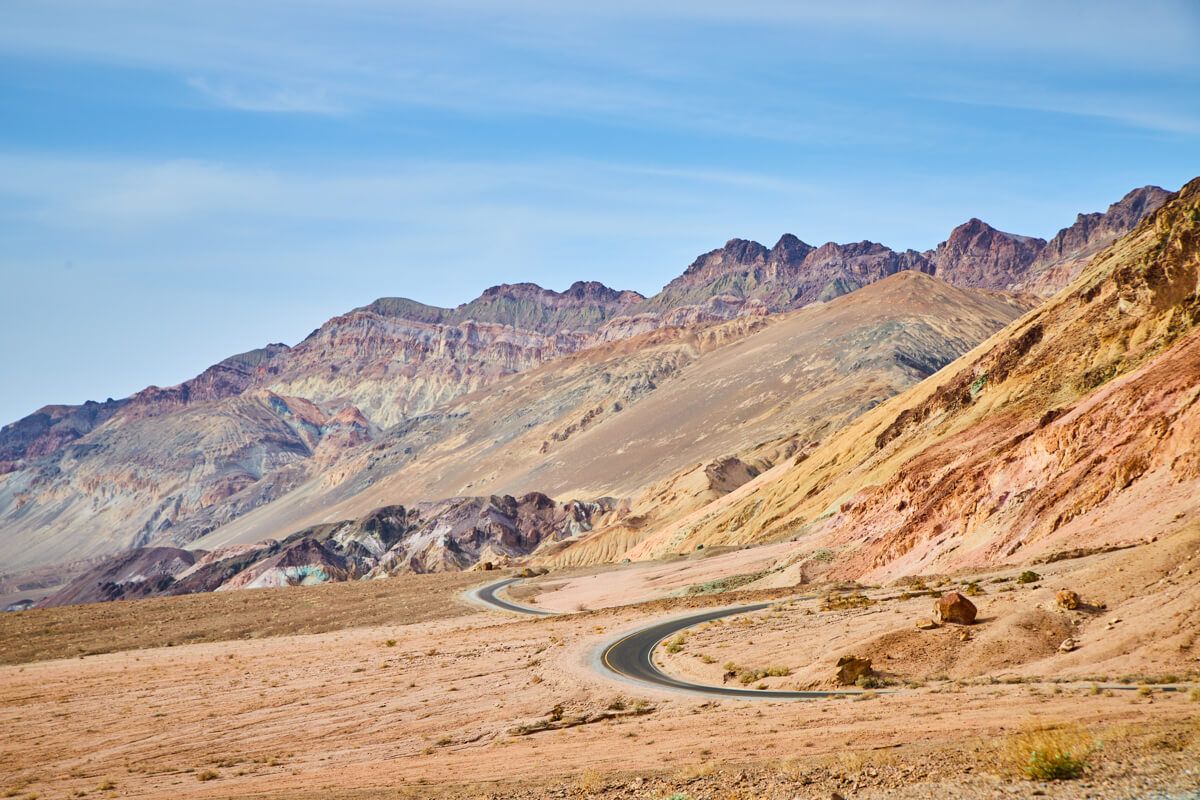
Stunning winding road through Artist's Drive
Second main view
Detail of main colorful formations
The journey is just as stunning
5. Keane Wonder Mine
Ok, we are DONE exploring that southeast region of Death Valley. Honestly, those first 4 spots above being so close together and in one region gives you a great taste of this National Park if you only have time for a half day.
I would say the above four spots likely will have consumed your morning, so it isn’t a bad time to think about lunch. There aren’t too many spots for food in the park so packing food is the safest plan. This spot, along with the next spot, are both taking you into the Northeast region of Death Valley.
Keane Wonder Mine is a spot, admittingly, that I did not spend much time at. I did NOT do the full hike, but instead followed a ranger's tip that you can see some mining equipment within a short walk of the parking lot. There were a bunch of shiny pieces of stones covering the ground and this was a good sized piece of history to look at.
Ease of Access - 7/10 - This is a good 1 mile of gravel road that can get a bit bumpy. It is also only about 1.5 cars wide but is not a one way street. So, not only must you watch for oncoming traffic to take turns passing carefully, but you should also watch the road carefully for potential pot holes to navigate around. Still, I don’t think it is terrible at all so long as you drive smart.
View of main equipment
Looking out over Death Valley
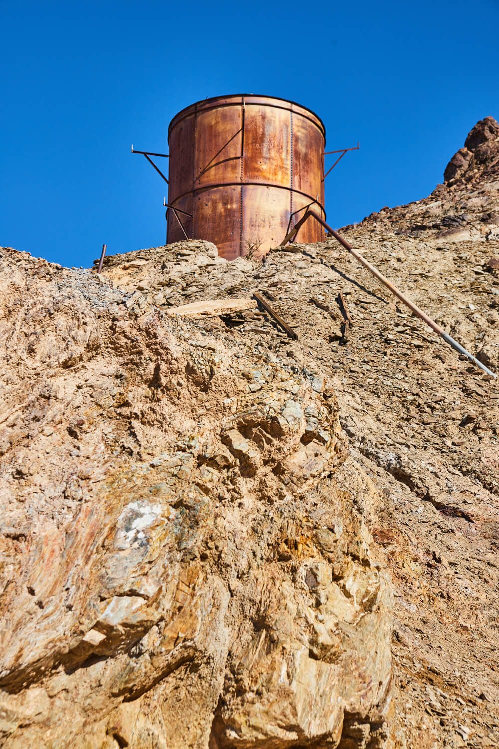
Detail of mining silo
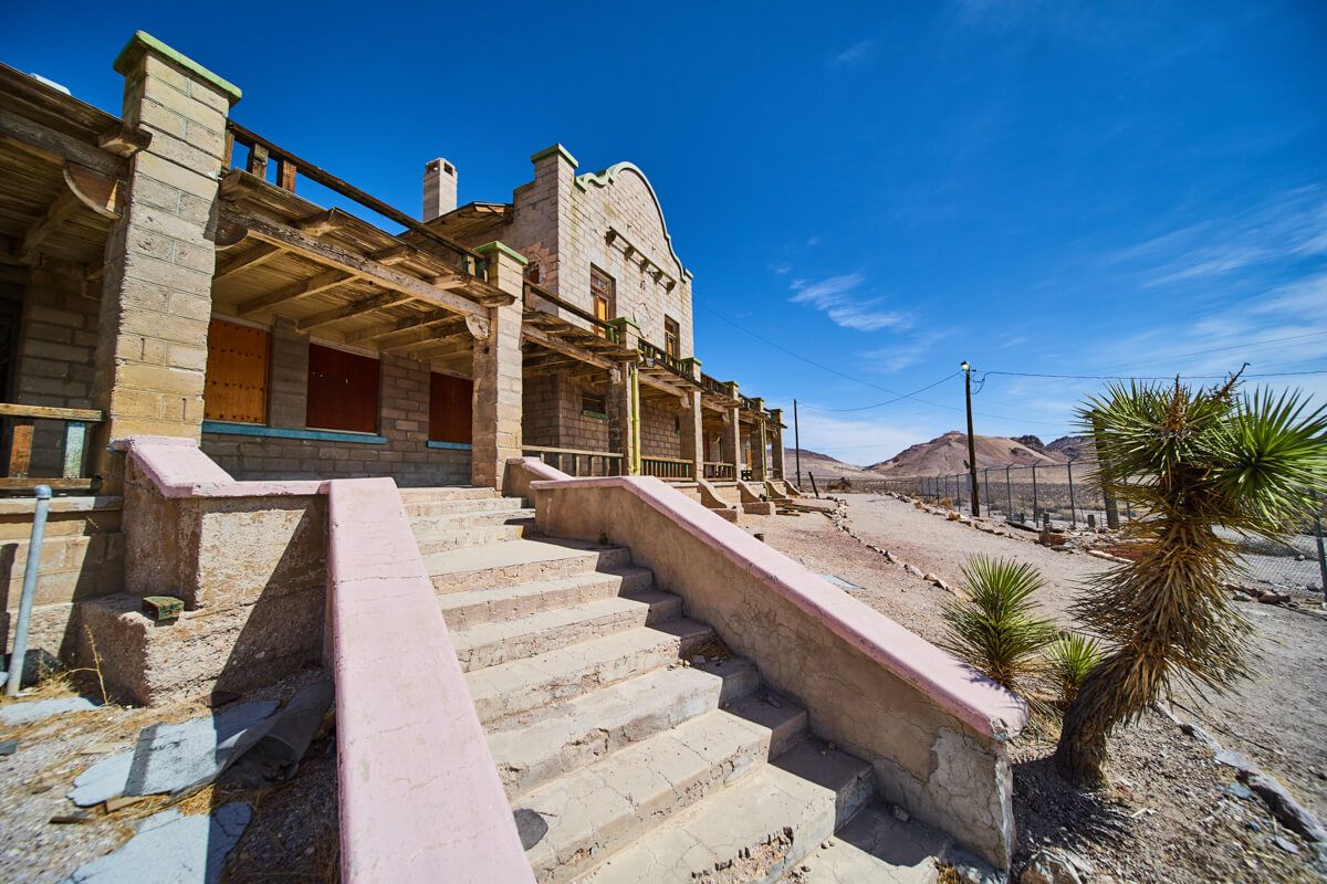
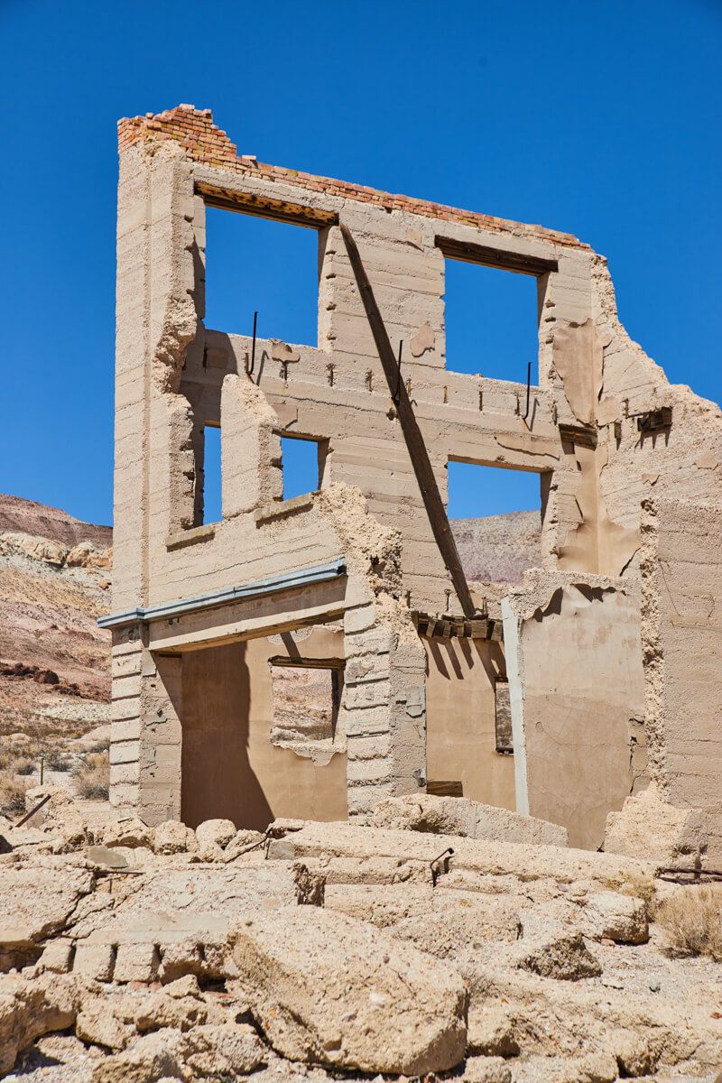
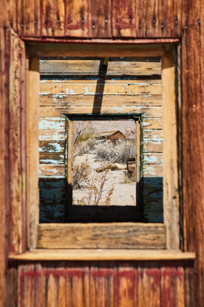
6. Rhyolite Ghost Town
I wanted to see some ghost towns, and I’m sure you do too! I came to the rangers with a list of ones I thought to see, but after talking to them it was clear that Rhyolite is the BEST one (if you are wanting that iconic “ghost town” look). Others that are marked as ghost towns might just be a small historical site but Rhyolite has a good collection of large old buildings. It honestly might have been my 2nd favorite spot in the entire park - and it’s not technically IN the park!
You will actually find yourselves back in Nevada, leaving the park from the southeast exit. If you made it here around lunch like I did, you can actually drive about another 5 minutes to the small town of Beatty. There are a few food options there and a gas station.
Rhyolite itself is absolutely amazing to explore. There are plenty of historical signs of information, along with all sorts of unique buildings: A colorful train cart, train station, old bank, stone arches, and even a house made of glass bottles - yes!
Ease of Access - 9/10 - You are taking the main paved roads and then the road into Rhyolite is gravel but very smooth and flat. No concerns here, not even pot holes!
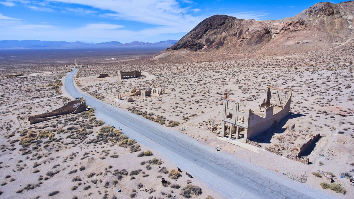
Aerial of main road
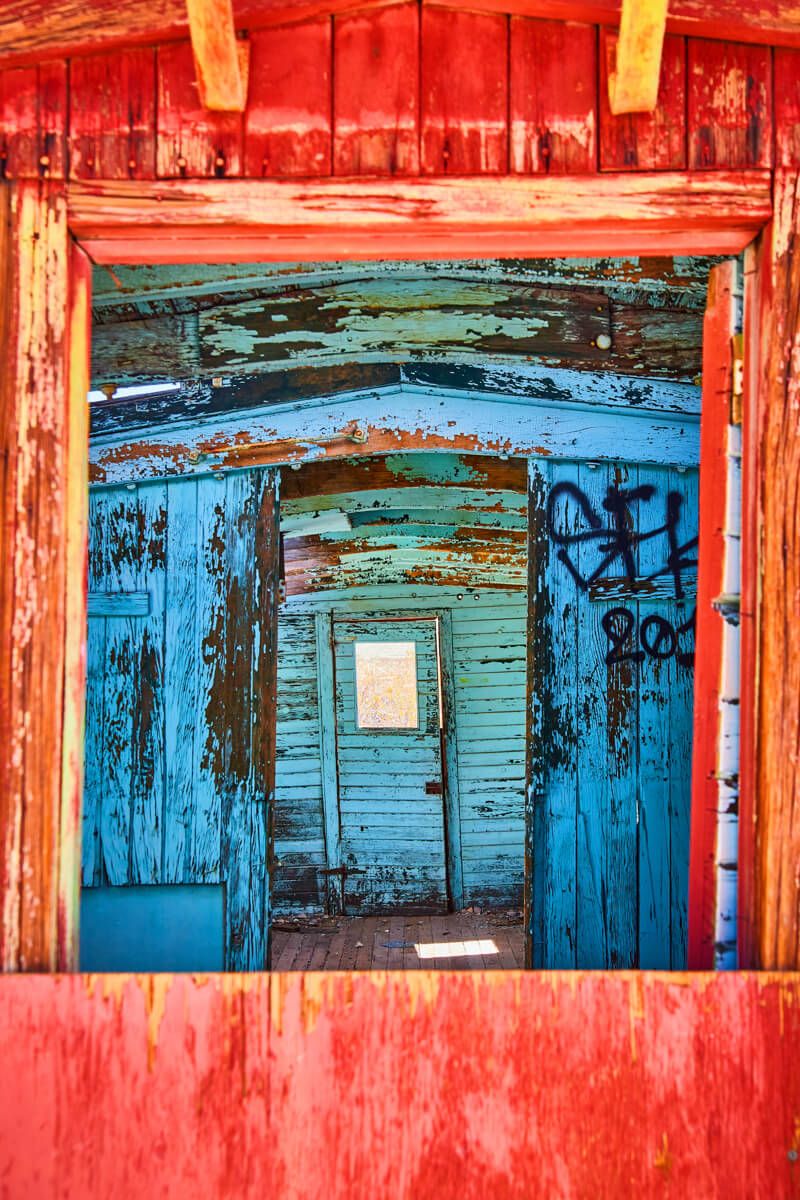
Colorful train layers
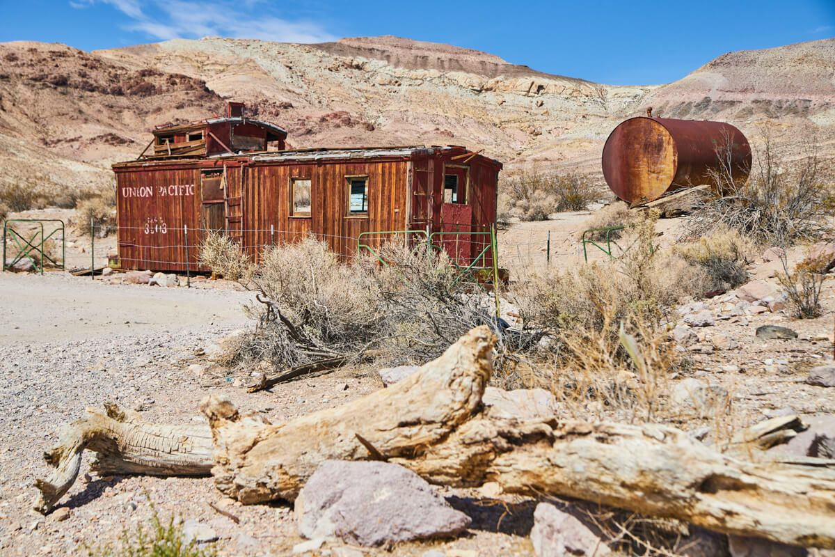
Union Pacific Train Cart
Train Station
Old Bank building
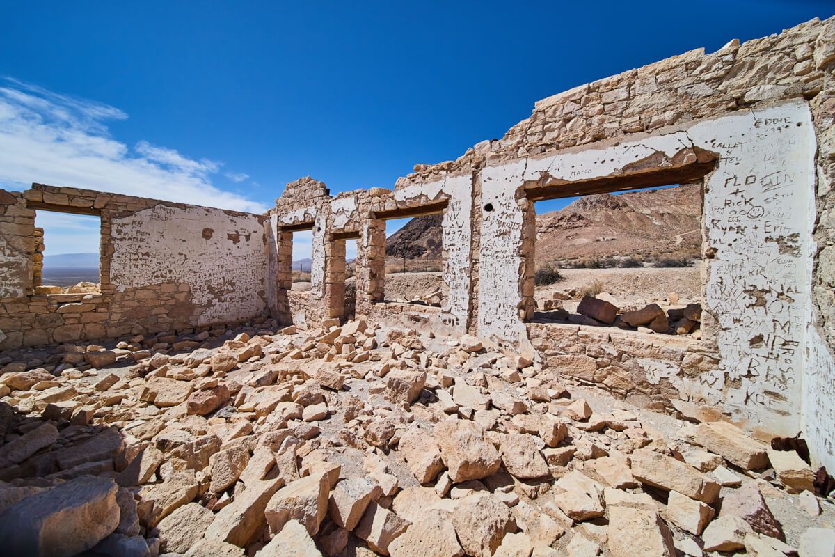
Names carved on stone walls
Train layers leading to abandoned cabin
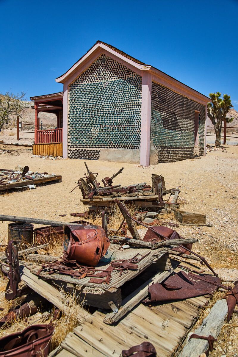
Iconic Tom Kelly's Bottle House
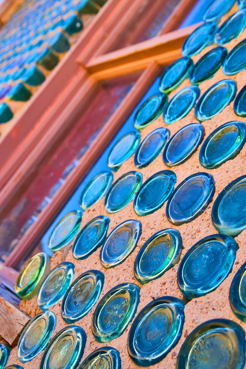
Detail of colorful bottles
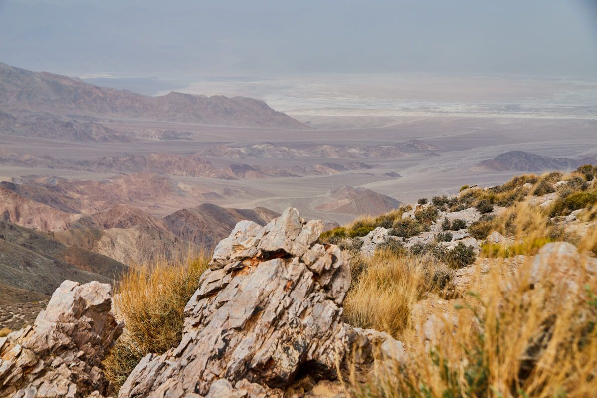
7. Aguereberry Point
Alright, your day trip is going well so far I hope! We have now explored the southeast and northeast regions. The last region is to the west. There is of course plenty to explore, however this spot and the next spot are the two I recommend. They are, however, the “roughest” roads so read my “ease of access” notes to see if they are for you.
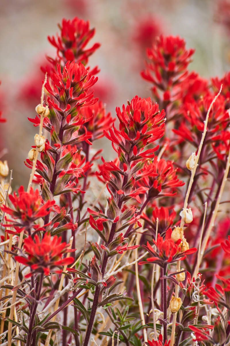
Aguereberry Point is one of those spots where the journey is nearly as amazing as the destination. The road here takes you past a part known for beautiful and colorful flowers lining the roads in spring. Then, as you make the journey up to the point itself, you are making a BIG jump in elevation. I’m talking from sea level to over 4,000 feet in a 30 minute drive. The road winds and curves up until you find yourself parked at the peak!
From there, you can take a walk out as far as you want along the peak to stunning 360 degree views of the entire valley. Just be careful the further you go out as it gets more and more narrow and you ARE pretty high up.
Ease of Access - 4/10 - This is the hardest spot on my entire list to get to. You have 2 or 3 miles of rough dirt road that is one lane wide but still two way traffic. Traffic was slow for me so that wasn’t much of an issue (I think I saw 3 total cars my entire time). But there were at least two spots where pot holes were intense for a few feet and you had to be careful. My car never scraped the ground, despite me thinking it might. Near the end, the dirt road is a pretty distinct drop off into oblivion but the road is plenty wide there to go slow and safe. If you take ANYWHERE off your list due to ease of access, it would be this one.
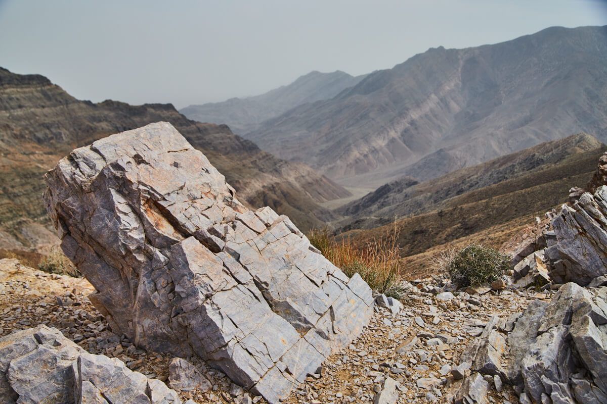
Stunning rock formations at peak
Beautiful flowers on road to the top
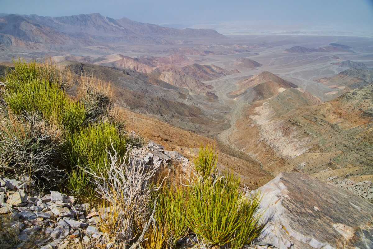
Endless views of Death Valley
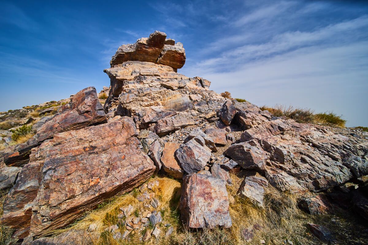
My favorite rock formation
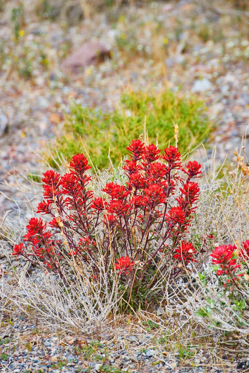
Red spring flowers on the journey
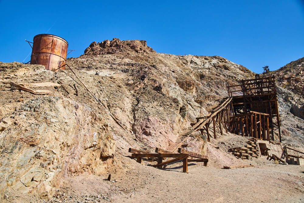
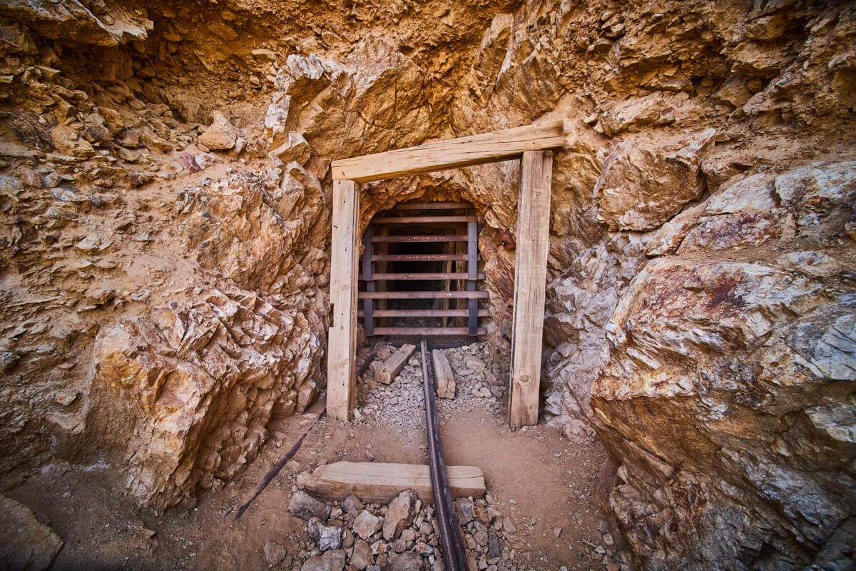
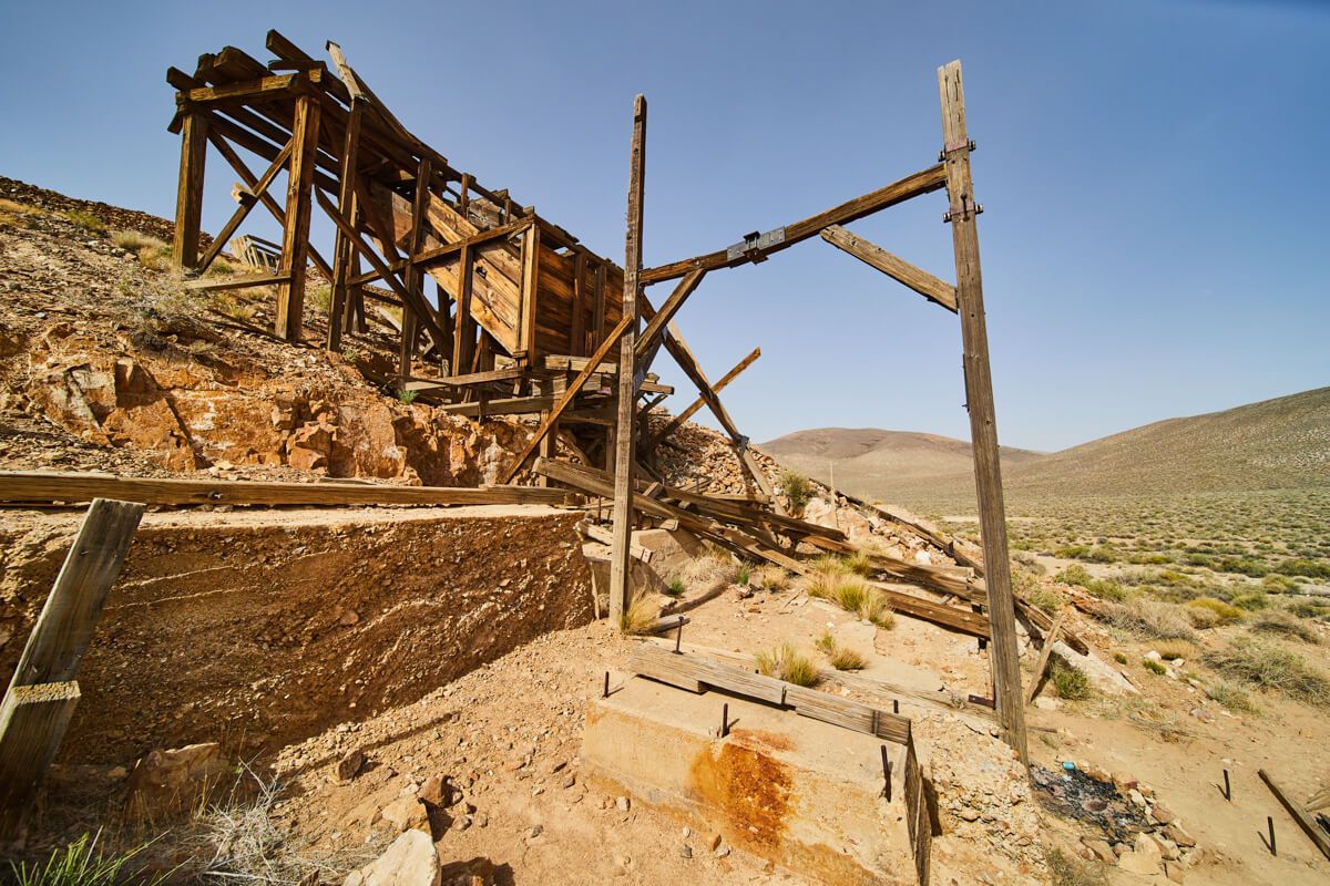
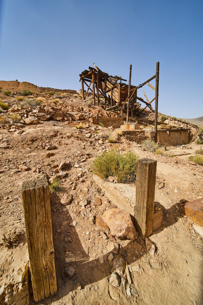
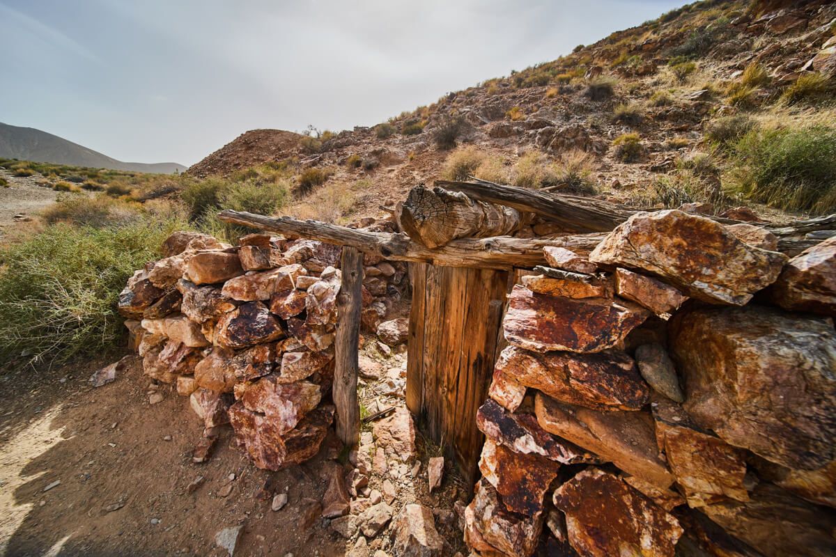
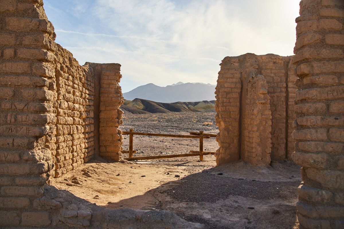
8. Eureka Mine
This is actually located directly on the dirt road that leads to Aguereberry Point, but well before the journey gets difficult. It was an absolutely stunning spot, with a huge piece of mining equipment you can easily walk all around. The mining tunnel is also extremely eerie and there are smaller structures and barrels around this barren landscape. I found myself surprisingly spending over 30 minutes at this relatively small spot.
Ease of Access - 7/10 - Nothing like Aguereberry Point, despite being the road that leads you there. Up until this point it IS still that narrow dirt road. However, you haven’t started to go up in elevation so it is a pretty straight drive with no notable pot holes of concern that I saw. It is a very short walk then to the mines.
Eerie tunnel entrance
Entrance to mining equipment
Abandoned single room structure
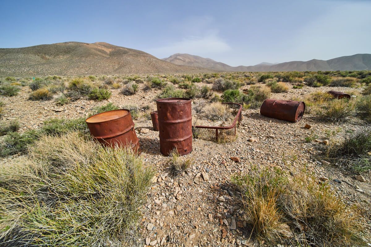
Lone barrels by mines
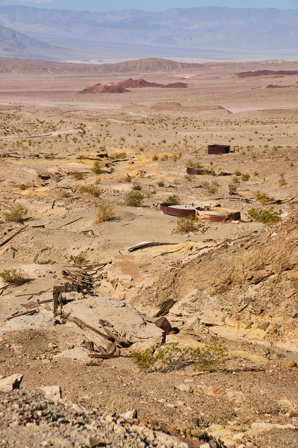
Honorable Mentions
Those are my eight favorite spots, but I did want to share some other random images I enjoyed. Many are simply along the drives between the above 8 spots. One great and easy to access historical spot would be Harmony Borax Works. It is right by Furnace Creek, so if you want to ADD it to your list, it would go right before Keane Wonder Mine as you can stop by there on the way.
Mirage captured
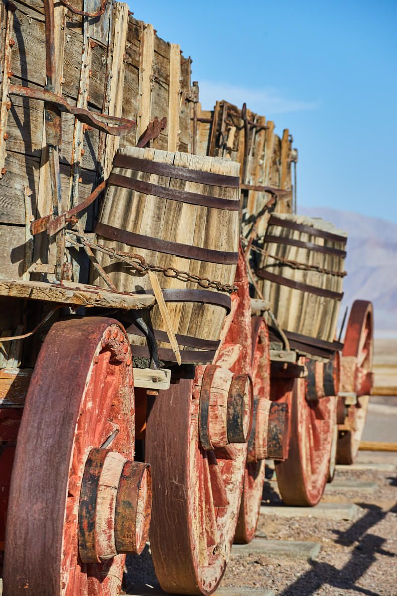
Detail of train at Harmony Borax Works
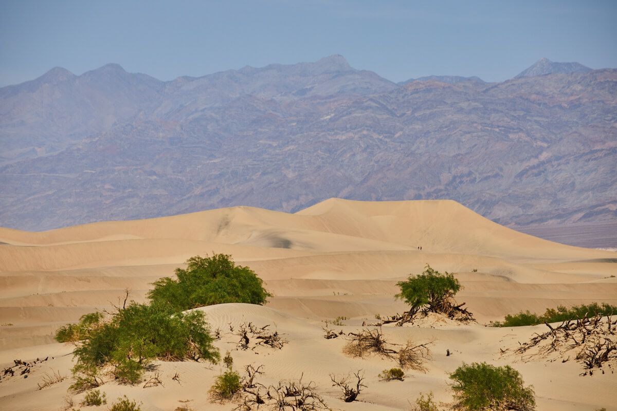
Mesquite Flat Sand Dunes
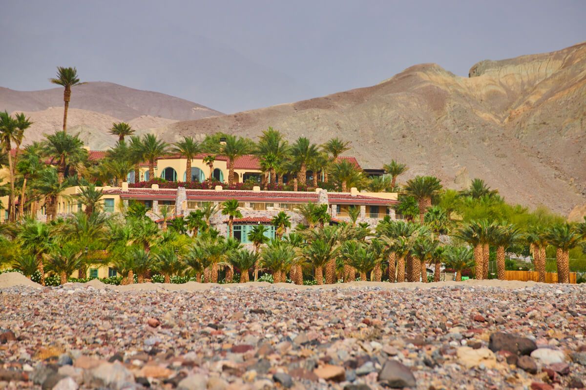
The Inn at Death Valley - an oasis in the desert
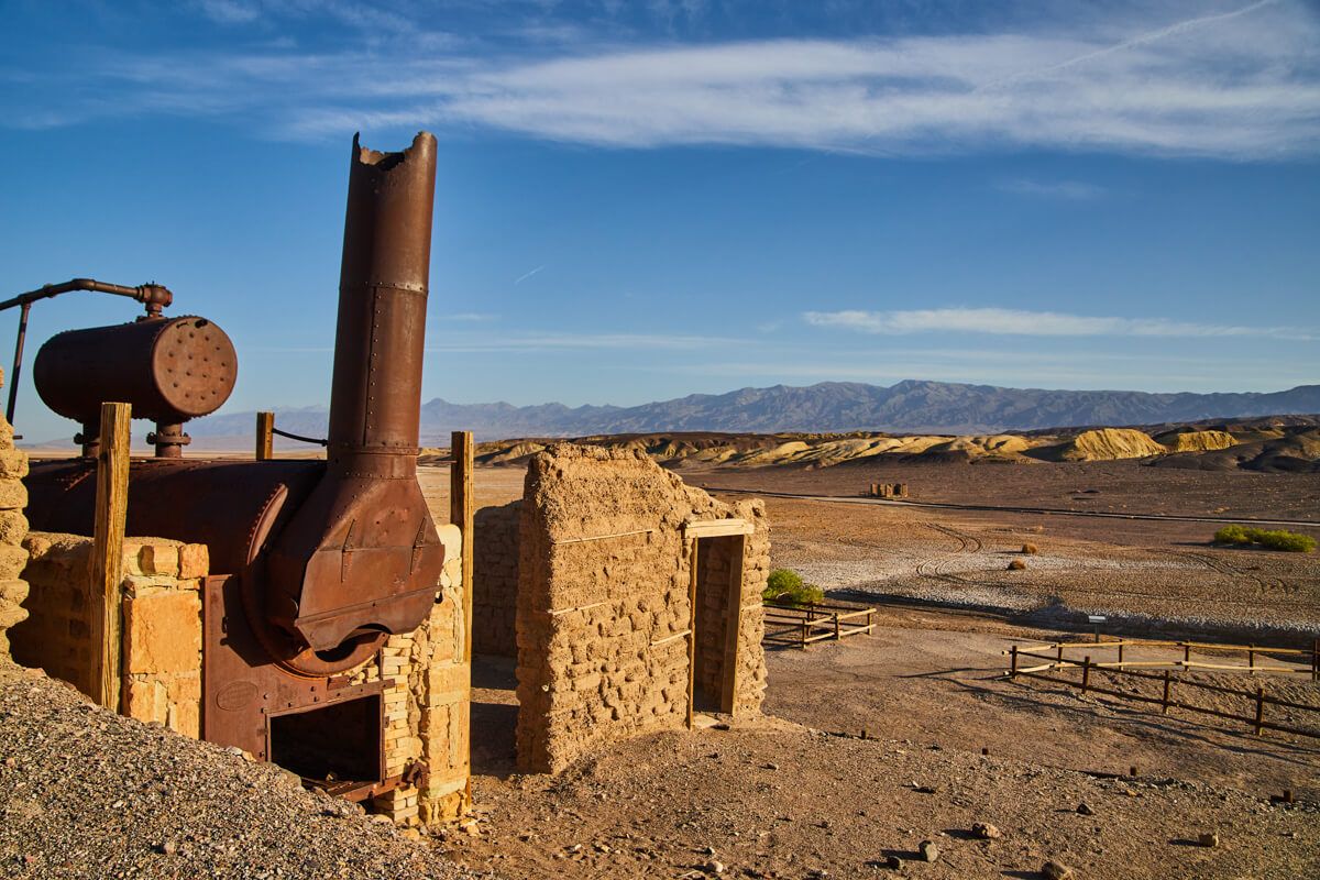
Harmony Borax Works
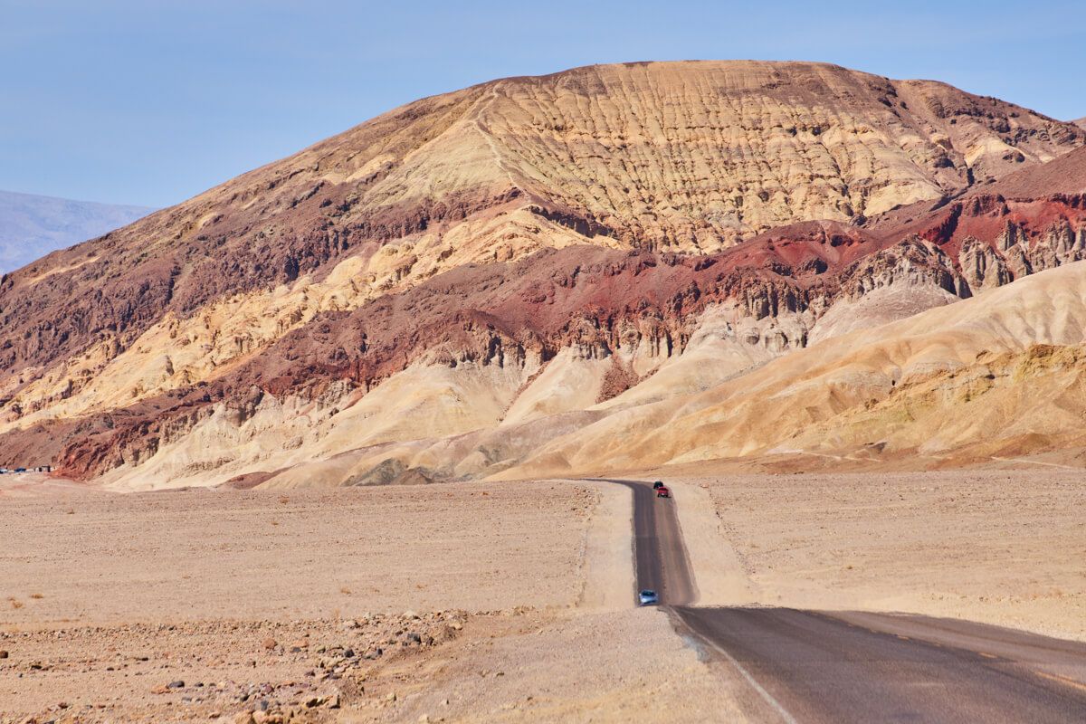
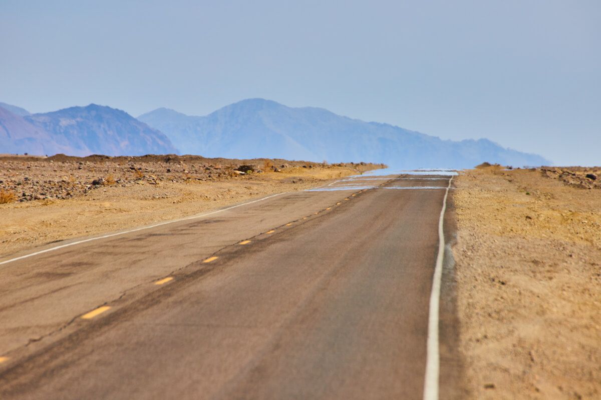
Roads through Death Valley
Old structure at Harmony Borax Works
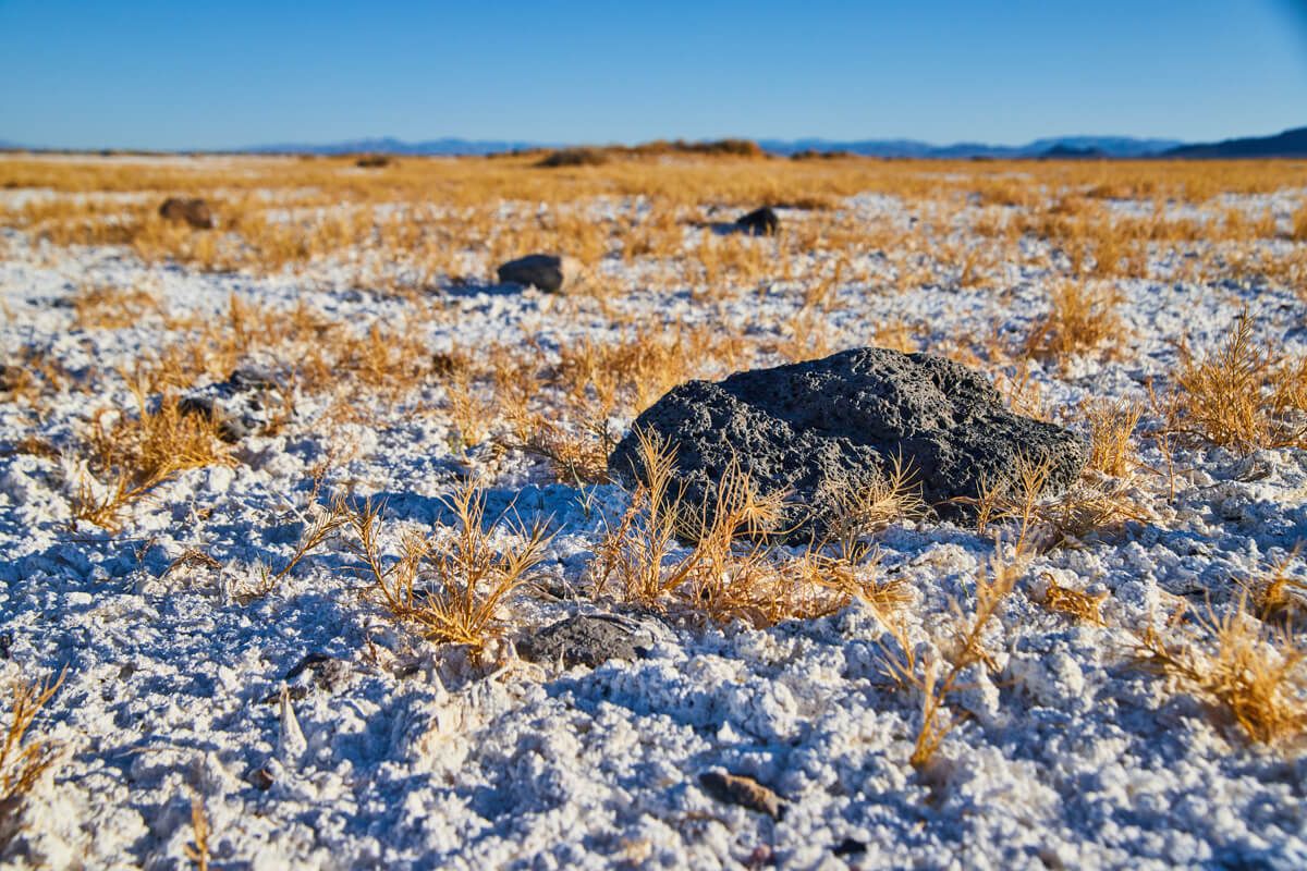
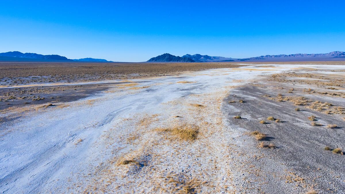
White sand and lone rock
Conclusion
Overall, the list above not only covers some stunning views, but also, for a day trip, it does an excellent job of being on easy roads to access AND has very little hiking involved. You can get in and out of each spot while enjoying the drives along the way.
I have no doubt I could spend a WEEK here exploring, but one day did genuinely leave me feeling content. If you’ve been to Death Valley, I’d love to hear what YOUR favorite spot was in the comments below!


About the Author
Founder and visual artist, specializing in all aspects of a businesses presence from imagery and video to graphics and web. A graduate of IPFW with a Bachelor in Fine Arts, Concentration Photography as well as an Associates Degree in Business. His personal photography works are focused on landscape, travel, and aerial photography.