South Mineral Campground
After driving an hour through the narrow and dangerous pass of Million Dollar Highway, you drive 7 miles down a simple gravel road through a valley in the Rocky Mountains and park roadside in the middle of nowhere with not a soul to be seen. You walk through the woods for half of a mile to reveal one of the most majestic and beautiful blue waterfalls tucked into a gorgeous cliff gorge that you have ever seen. You only have an hour of time due to sunset and not expecting to find something so amazing, and spend the next 3 years wanting to come back. That was me in 2018 when I first discovered the South Mineral Campgrounds.
I am now happy to say I have had a successful revisit, but the journey to get here was much more complicated than last time.
Feel free to endure my painful journey that is about to follow, or scroll a bit further to my favorite 29 photos from my visit.
Obstacle One: Forest Fire Closure
Even the most detailed of trip planning can miss small, yet essential, details. I planned this trip about six months in advance and failed to expect or find any information that indicated the campground might be closed. Imagine getting plane tickets, renting a car, coordinating lodging, getting all the way to Colorado, waking up on the first full day filled with the excitement of finally going to the #1 destination of your entire trip (don't get me wrong- there are plenty of other things to do around this area), and driving towards the campground, only to be met with a road closed wall of warning signs just 2 miles away from your destination. The level of depression that proceeded this moment in time was intense. It pretty much felt like I had to convince my brain that it was going to be ok to NOT get to see the one thing this entire trip was built around.
The story behind this closure is that there was a fire in the mountains above the campgrounds back in 2020. The fire affected a wide area and you can see from both the video below and the very last photo on this blog the damage that was very close to the South Mineral Campgrounds waterfalls themselves: Hundreds of fallen and dead tree logs filling the canyon next to the mountains. The sad news is that one of the amazing waterfalls seems to be destroyed or at least completely buried by these logs. The good news is that the main area I wanted to explore was outside of danger and in fact did not seem to be at all affected by the damage.
I got back to our hotel and, after having given up all hope for a good amount of time, decided to do some research about the closure.
You will not believe the results that fate delivered upon me.
The campground was tentatively scheduled for reopening the day before we flew back home. Of course, the day we flew back was not at all an option as we had to leave for Denver around 4am. There was a sliver of hope: The last day of our trip. After some calls, it seemed that they were planning to inspect the area in a couple of days (at this point about 5 days before we leave) to decide IF it could open as scheduled. The woman I spoke with seemed to be thinking it was much more likely to be kept closed, as it was dangerous in the area.
Yes, after over a year, the damage from a forest fire can cause that much harm and danger. It seemed after the fire that heavy storms and rain caused further issues by pushing damaged trees and whatnot down the mountainside. NOT safe to be near.
I was told my best hope was to call after the weekend to see the verdict (at that point - just 3 days before we leave). I maintain a tiny thread of hope, but by now I had explored enough other interesting places to "nearly" accept going home without seeing this location. Luck would have it that they decided to reopen on schedule - early that morning on my last day to explore.
It became my plan for the entirety of the last day before flying out to explore these majestic waterfalls. It was unfortunate that I only had one day to explore, as I had hoped to go there 2 or 3 times for different types of weather or times of day. But - at this point - it was 200% better than nothing.
*I did them a favor as well and made sure to update Google Maps that they were open, as it was marked as "temporarily closed".
Obstacle Two: Construction
I had seen some signs, pun intended, about an area being closed for certain times of days. I didn't think about it much until the night before I wanted to go to the campgrounds. We are somewhere pretty much "out there", you could say. We are in Ouray, Colorado. It has one main road going to it from the north and leaving it to the south. South is where I need to go, on that only road that goes that way. Guess which road decided to start construction the day before? You guessed it. This road is the dangerous but scenic Million Dollar Highway.
Take a detour, you say? Good idea, one would think! The construction was scheduled during the weekdays as follows - 8am to noon. 1pm to 5pm. So, either leave super early (around 6:30am) to get past the construction before it starts) or try to get in the gap around lunch (loosing the whole morning). Leaving after 5pm was not an option, I would be stuck with just as little time to explore the campgrounds as the FIRST time I came here.
The bigger issue was not knowing when they would officially reopen the campgrounds, as it was phrased as "mid morning". Getting there at 8am could result in being stuck waiting for a couple of hours for them to open. I decided that was worth the risk, so that I would have all morning and afternoon to explore.
But back to "why not take a detour". That is because the only detour option is to QUITE LITERALLY navigate completely around an entire mountain range. Would you believe the detour time would add about 3 hours to the drive, ONE WAY. Yeah, so you would genuinely have been better off waiting for their lunch break then spending 3 extra hours driving around. That was a waste of time.
Obstacle 3: Is everything intact?
Believe it or not, those were the only main obstacles. This last "obstacle" was the genuine fear that gripped my mind during the entire drive:
"What if the waterfalls were destroyed by the fire"?
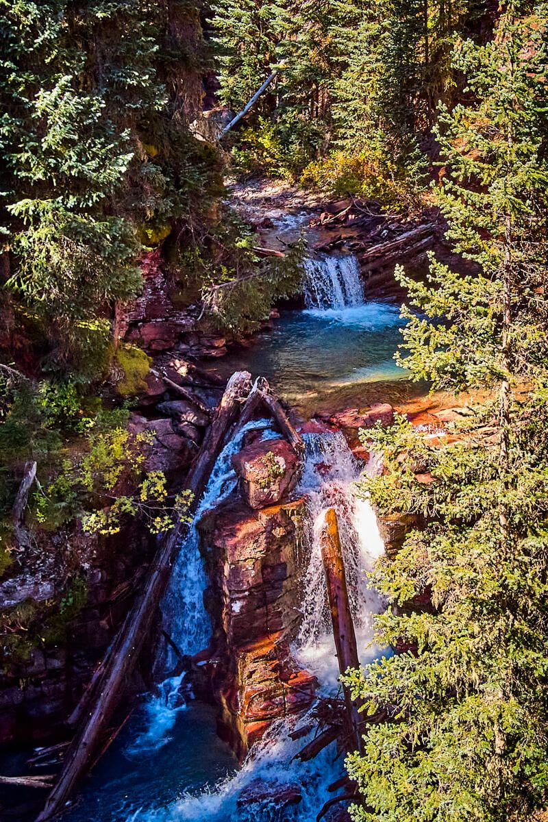
It was a serious possibility. If this area was closed due to dangers, I had NO idea what to expect. I've already spoiled this above, but I was fortunate to find the majority of the falls were exactly as they had been before. Nonetheless, it was very sad to see the one section that did get destroy, which had been extremely beautiful before:
.jpg)
This now looks like this:
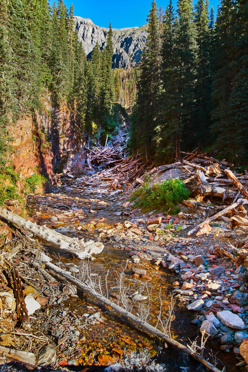
I still hold hope that perhaps the above waterfall is buried under those trees, as the location of that waterfall was about a quarter mile walk down the river in the above photo filled with logs. Perhaps it did not get completely destroyed but is just hiding and waiting for those trees to be cleared out? Someday I may find out!
Exploring the South Mineral Campgrounds
So, how was it? It was amazing. Being somewhere so serene and peaceful cannot be explained easily. I spent about six hours exploring to my heart's content. In that time, other than the parking lot (nearly all of which were people wanting to hike UP the mountain), do you know how many people I met on the path and around the falls? Four. I saw 1 person on top of the falls when I was below, but never saw them again. I saw another group of 3 as I was leaving.
It is rare to find something so majestic and yet also so isolated, considering it is practically a "roadside waterfall". The hike is less than half of a mile. I understand there are places you can hike 5, 10, 20 miles into the wilderness and find something truly stunning. I am not surprised that you might not see a soul for hours at a location like that. But this is not that, this is a very short walk and very easy to access. This is why I describe it as Colorado's Best Kept Secret. Even their Google Maps listing will leave you baffled, with just 77 reviews at the time of writing this. That listing is just for the campground itself, as the waterfalls don't even HAVE a Google Maps Listing.
However, what you WON'T find near this location are any signs indicating there are waterfalls here, or really anything here at all. There are the campgrounds of course right here, and even the signage there doesn't note ANY trails or ANY information about these waterfalls. I only found them through Google Image searching places in Colorado. There are many blogs that talk about it and mention how fantastic it is, often rating it in their top 10 list for all of Colorado.
Yet, somehow, they have successfully kept it a relatively hidden secret and not advertised it at all. There also really aren't too many trails here, though a few spots certainly are trailed. None of the trails include anything built, as far as wood / rails / stone steps. Nothing at all, just at best a footpath through some tight areas. You are almost fully set loose to explore in any direction and find these waterfalls.
New Hidden Secrets
The last thing I will share before letting you get to the photos are the NEW hidden surprises that the South Mineral Campgrounds had for me. Because my previous trip had been so short, I didn't get the chance to explore much beyond the lower and main waterfalls. What I did NOT know about, nor expect, was to find an additional THREE waterfalls above the main falls. The "path" (as mentioned- there really aren't any paths) to those falls can be dangerous. It is narrow, it can be steep right next to the cliffs that drop off into the gorge, and the ground covered in pine needles doesn't help with slickness. I found myself with my walking stick moving very slowly in many spots.
I safely navigated to the two next waterfalls. The third and final upper waterfall was tucked very dangerously in the gorge and I saw no clear safe path to get up close. All of the shots of that last upper fall below are taken with a drone. It is actually an extremely unique waterfall, pouring through a narrow canyon like the lower falls, but falling into a large hole right in the rocks and creating a very nice pattern against those red rocks.
Happy with my shots, I was finally ready to move on and head home. I have three panorama's you can explore as well:
- 360 Panorama of Lower Falls
- 360 Panorama directly next to Main Falls
- 360 Panorama on top of upper two falls (this is directly on top of the main fall)
It is worth noting that, thanks to the construction, I had to stay around in Silverton (not a bad thing) for about 2 hours, waiting for construction to open the highway back up at 5pm. I enjoyed my time in Silverton, with great food and views.
So that's it, that's my crazy story to get to this one spot! It was all worth it. Enjoy the video and photos below and let me know how many of you were stressed out reading that story!
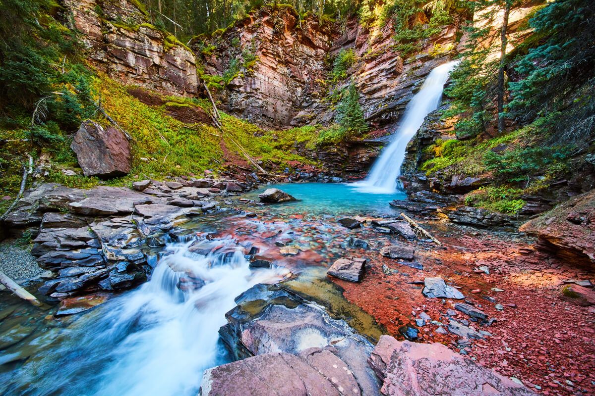
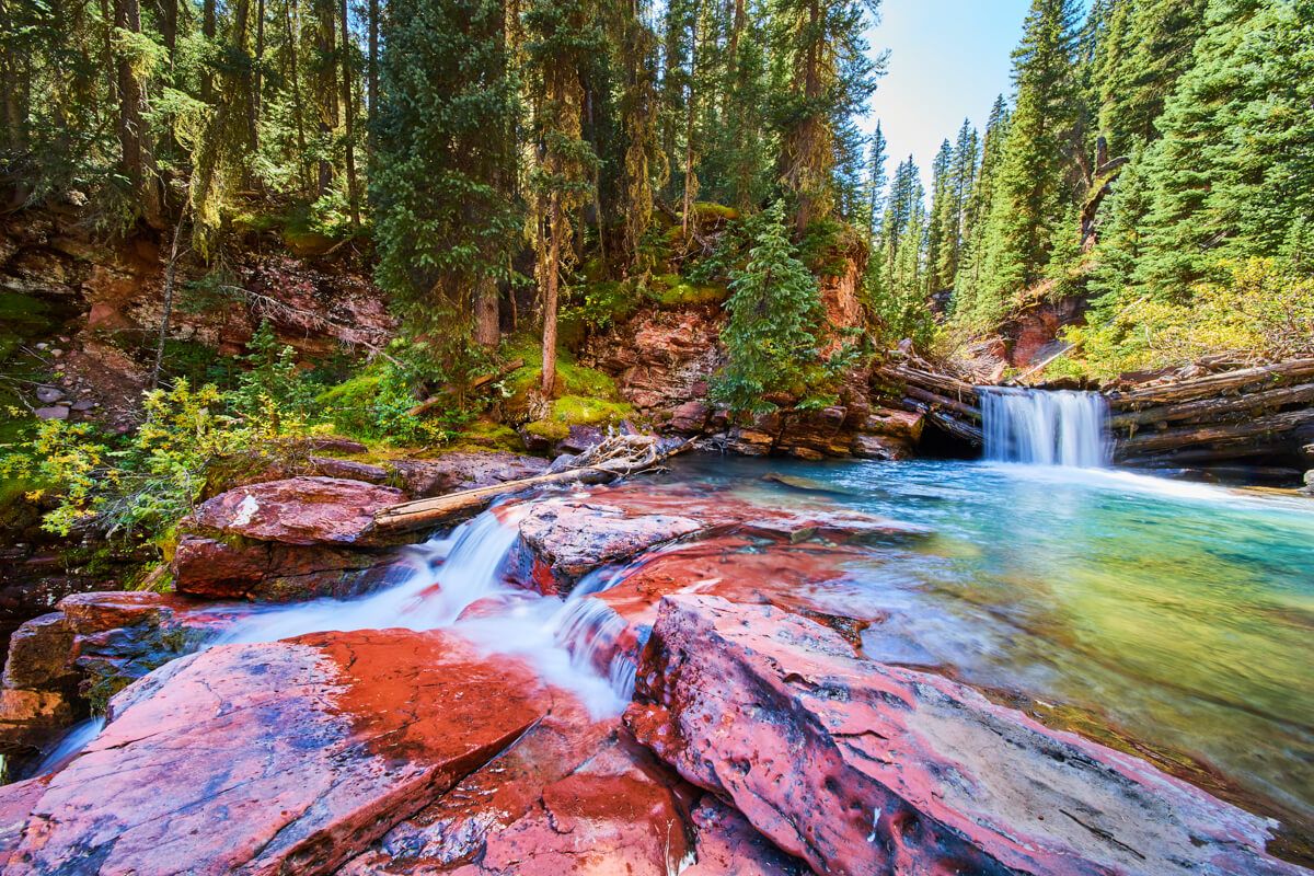
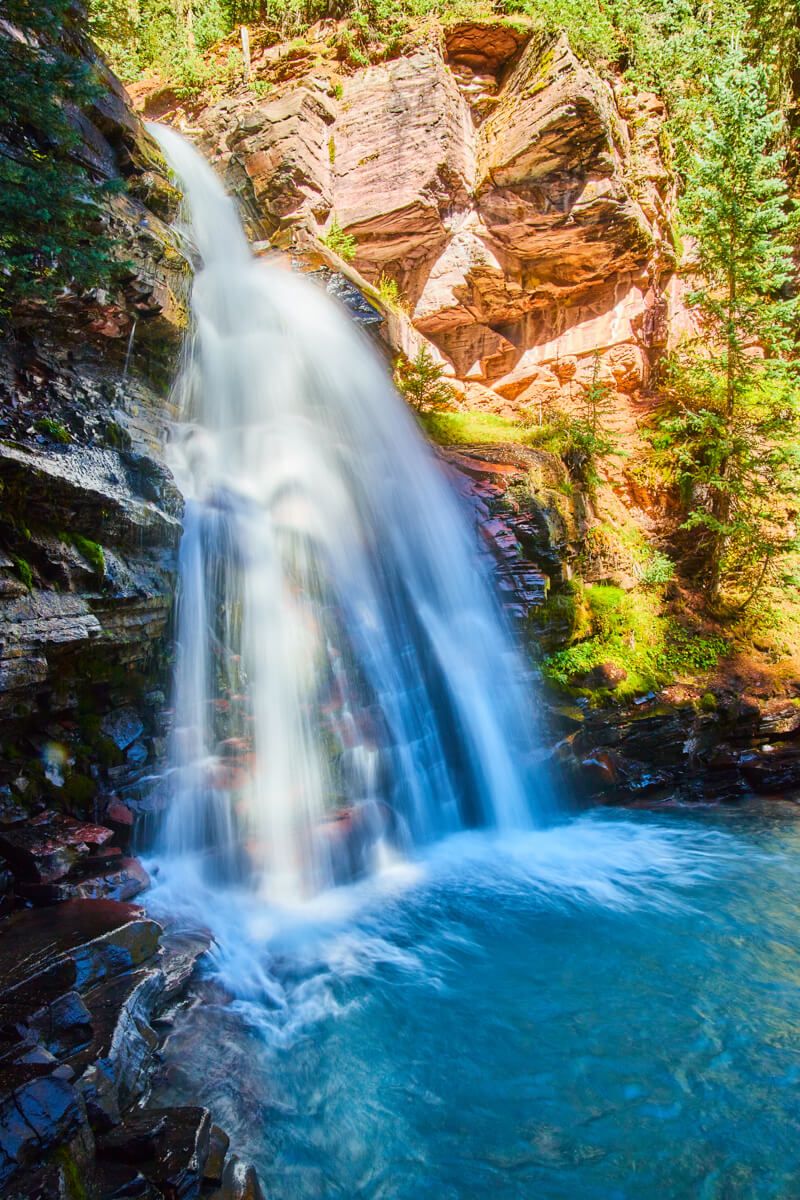
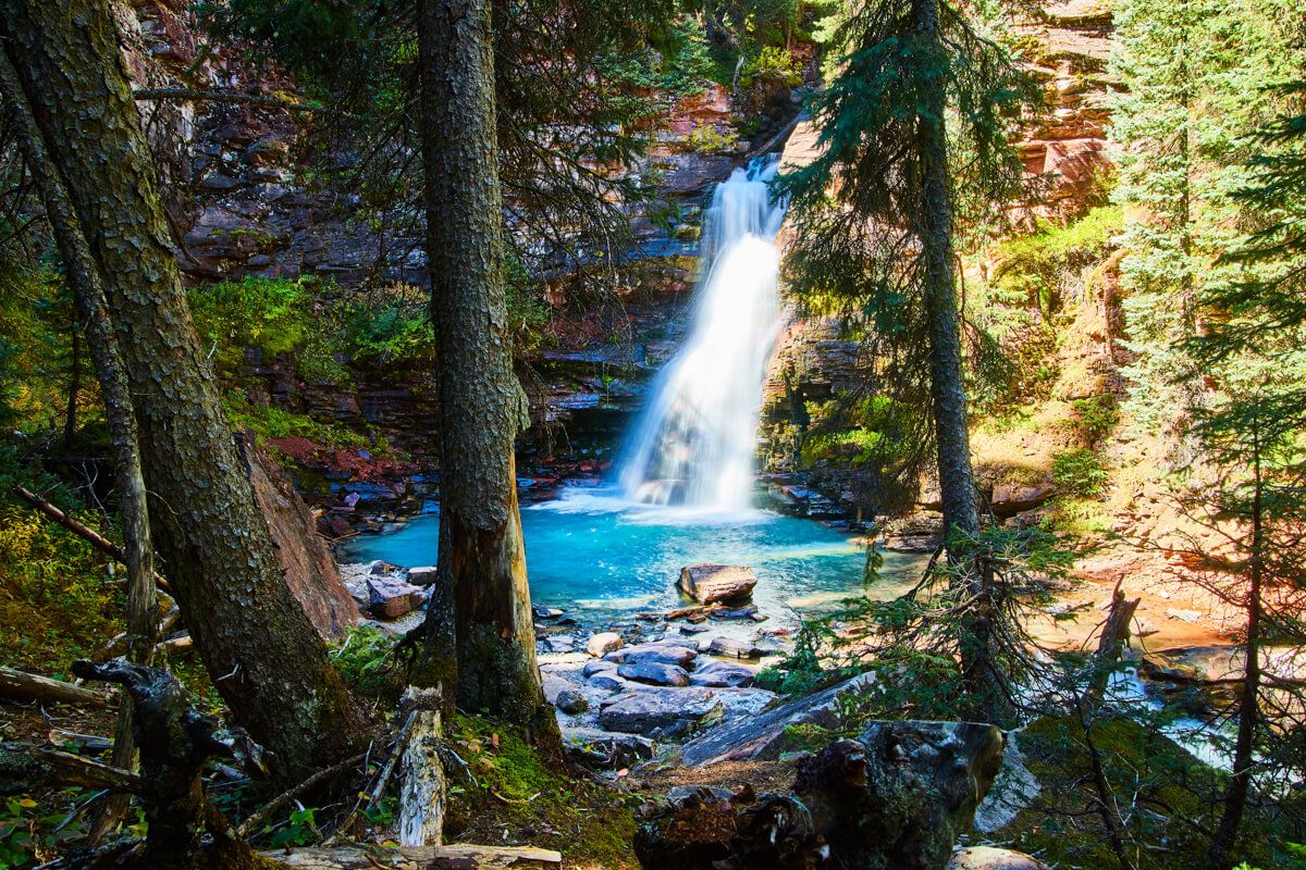
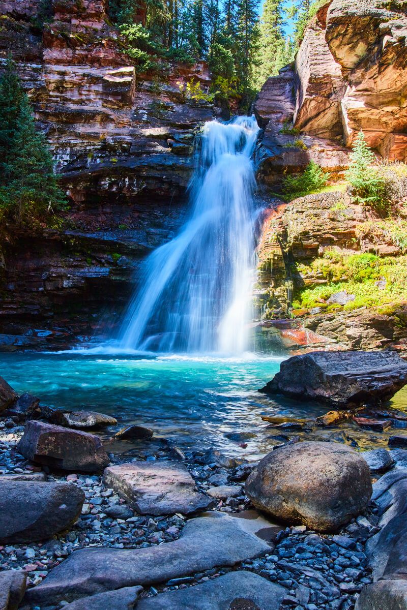
Main waterfall
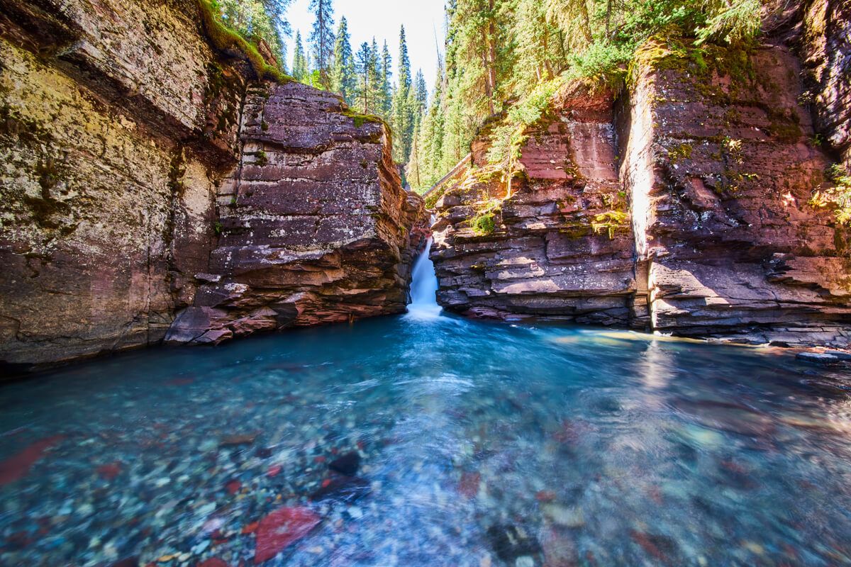
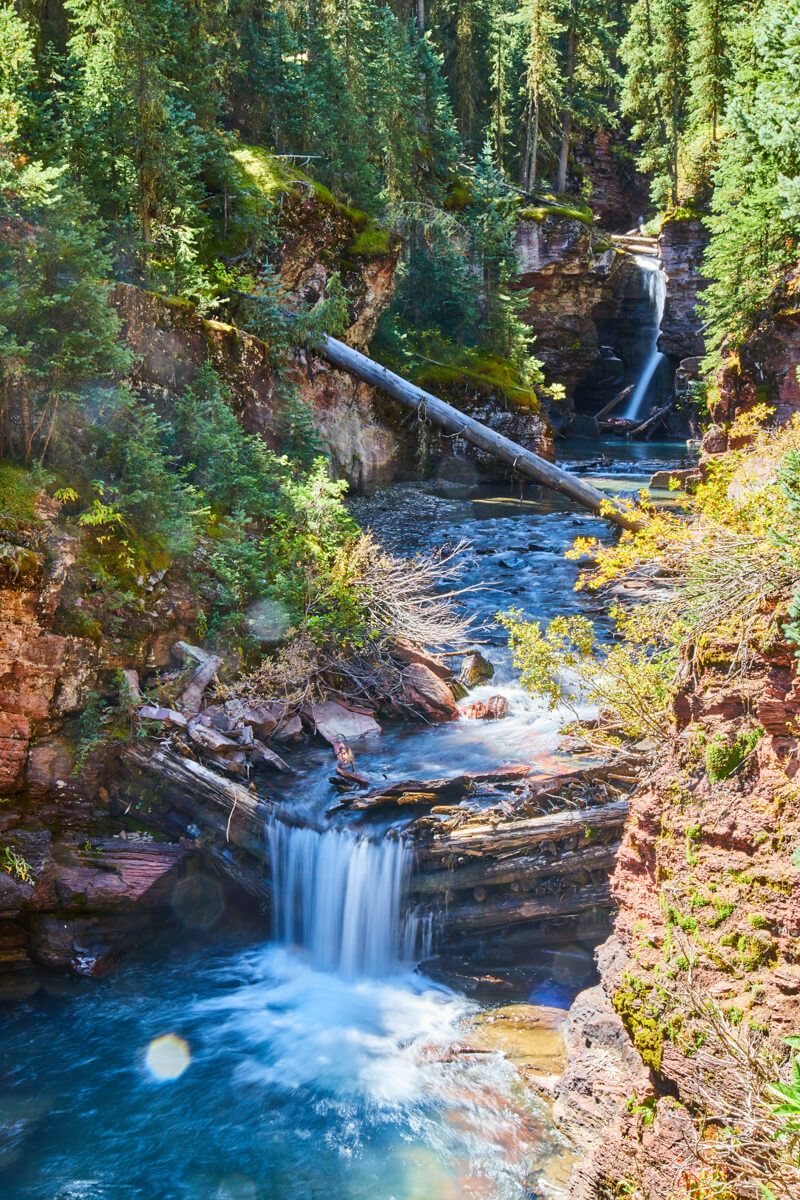
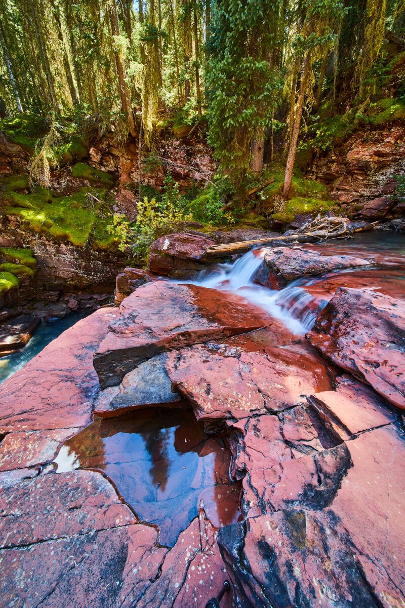
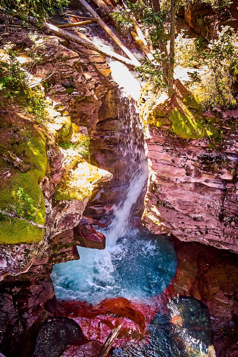
Lower gorge
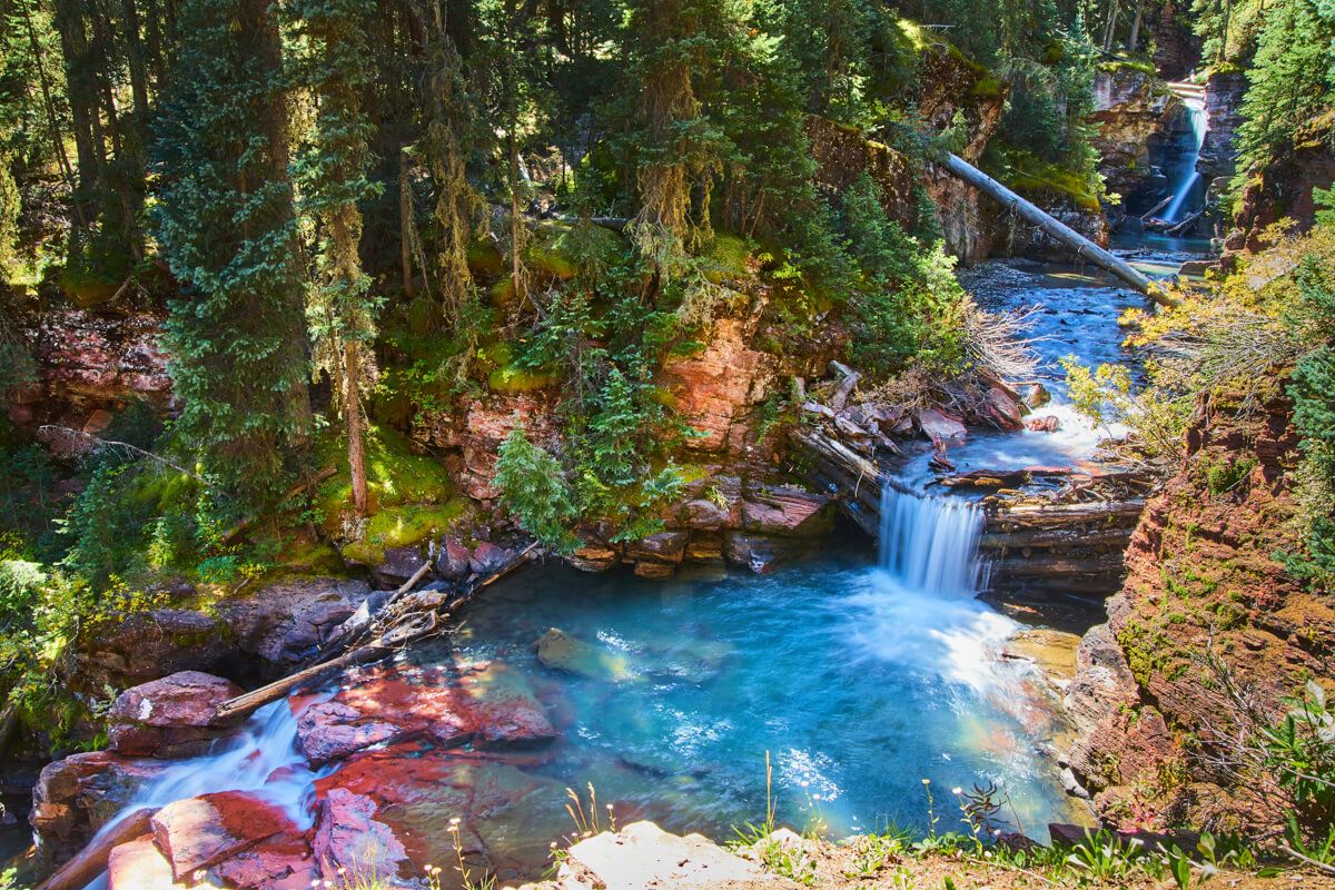
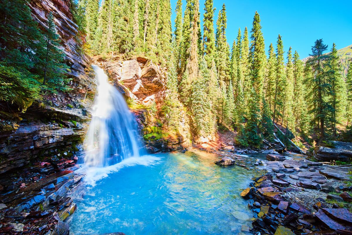
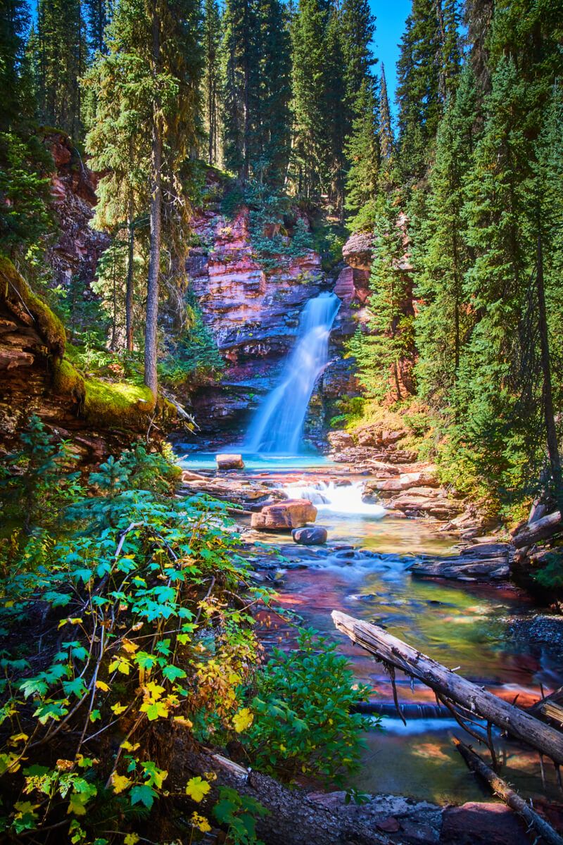
Middle falls
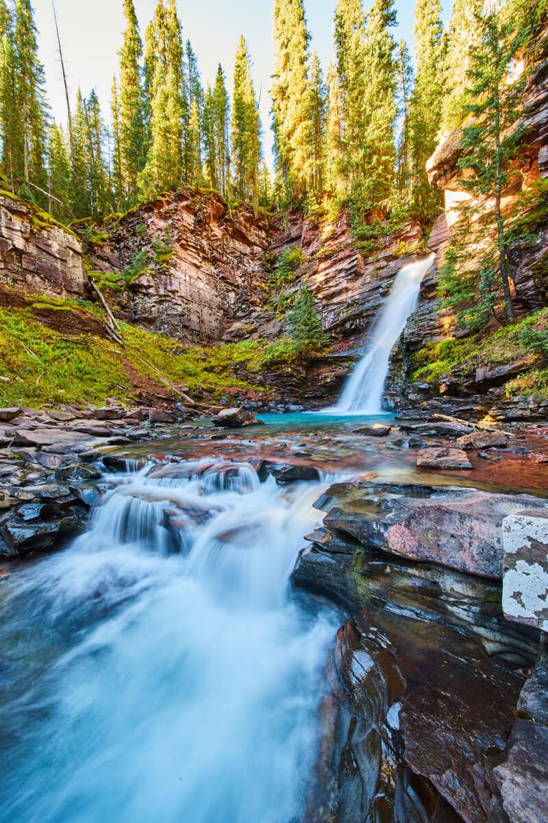
Main waterfall
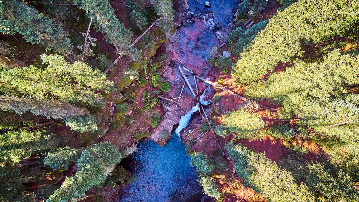
Aerial of Lower Gorge
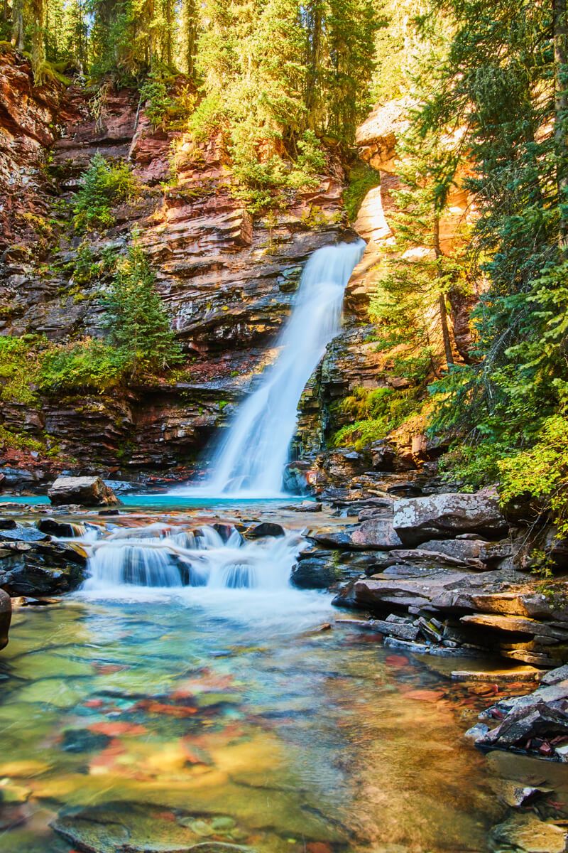
Main waterfall
Aerial of middle falls
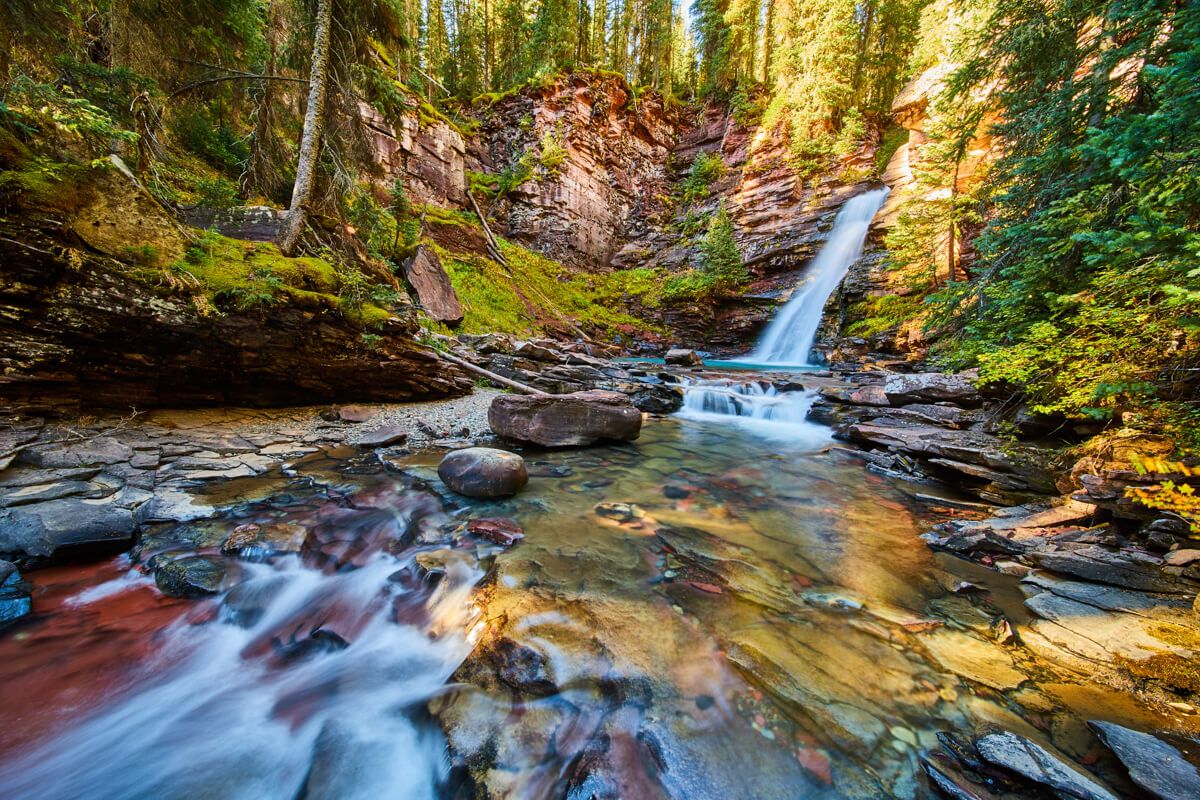
Main waterfall
Middle falls
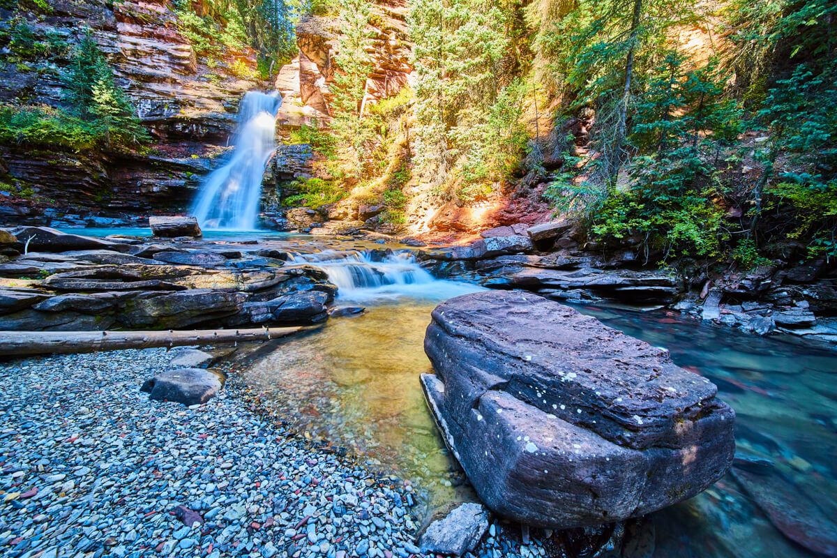
Main waterfall
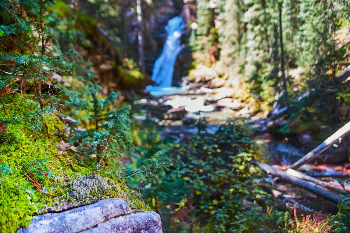
Baby Pine Trees
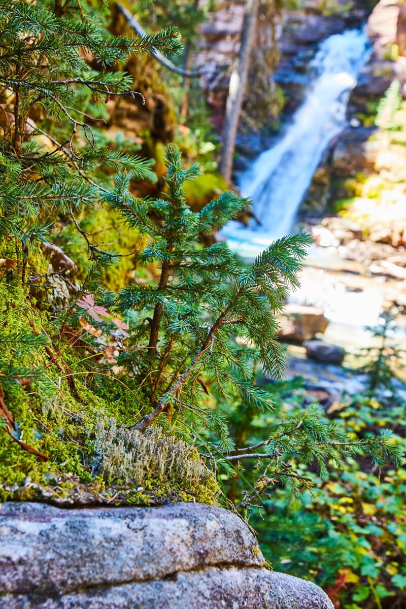
Baby Pine Trees
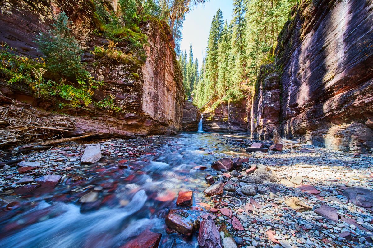
Lower gorge
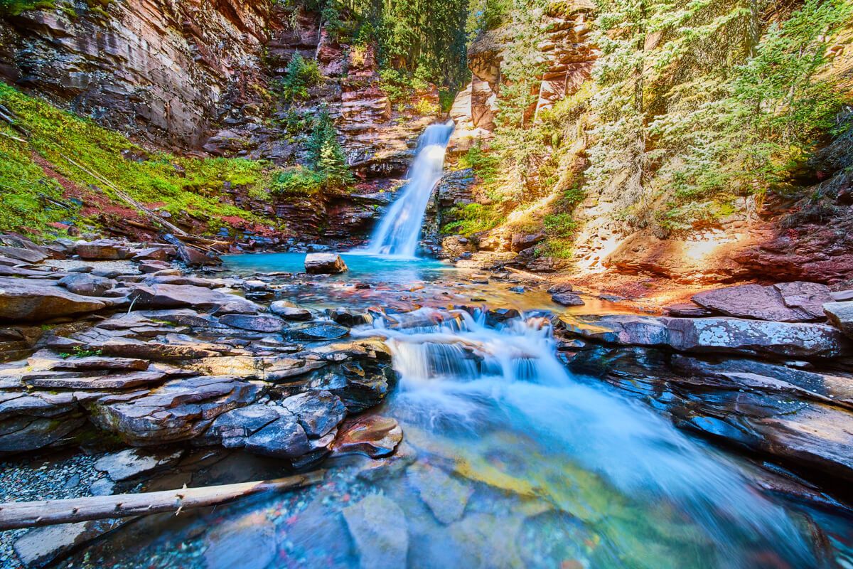
Main waterfall
Main waterfall
Middle falls
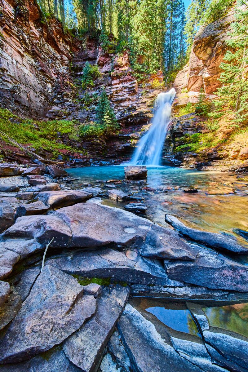
Main waterfall
Aerial of upper falls
Main waterfall
Middle falls
Main waterfall
Main waterfall
Aerial of upper falls
Main waterfall
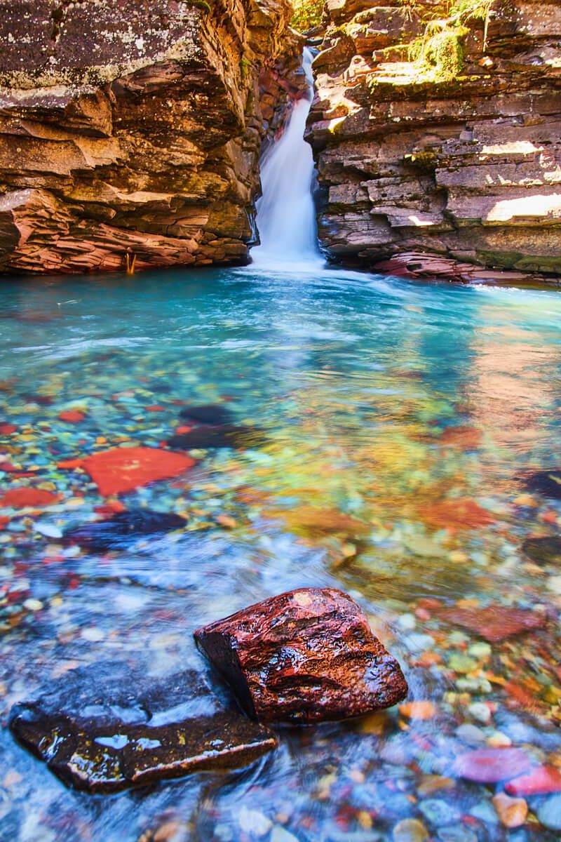
Lower gorge
Main waterfall
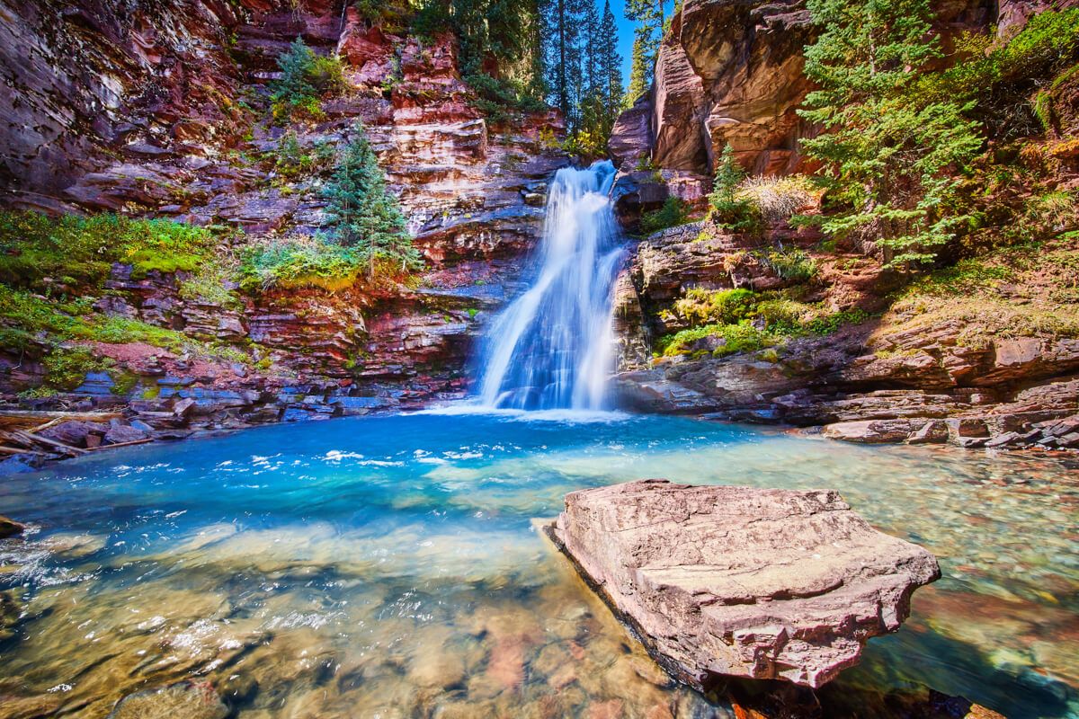
Main waterfall

Aerial of forest fire damage


About the Author
Founder and visual artist, specializing in all aspects of a businesses presence from imagery and video to graphics and web. A graduate of IPFW with a Bachelor in Fine Arts, Concentration Photography as well as an Associates Degree in Business. His personal photography works are focused on landscape, travel, and aerial photography.